Deception in the Desert: Death Valley West Side
The question I am asked most often is what trails I would recommend to someone with a stock or lightly modified SUV who wants to start exploring remote back country locations in the Mojave Desert. A stock Jeep Wrangler is a highly capable vehicle that can handle tough trails, but many people prefer to start exploring on very easy trails.
There’s nothing wrong with that; when you first start exploring in remote locations, the last thing you want to worry about is wondering if your vehicle can handle the terrain or having your vehicle break down in the middle of nowhere. It’s a good idea to be extra cautious until you get comfortable with the idea of being self-reliant in challenging situations. I want to stress that you should always travel with at least another vehicle, especially if you are new to exploring off the beaten path.
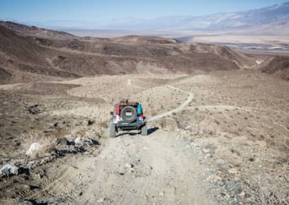
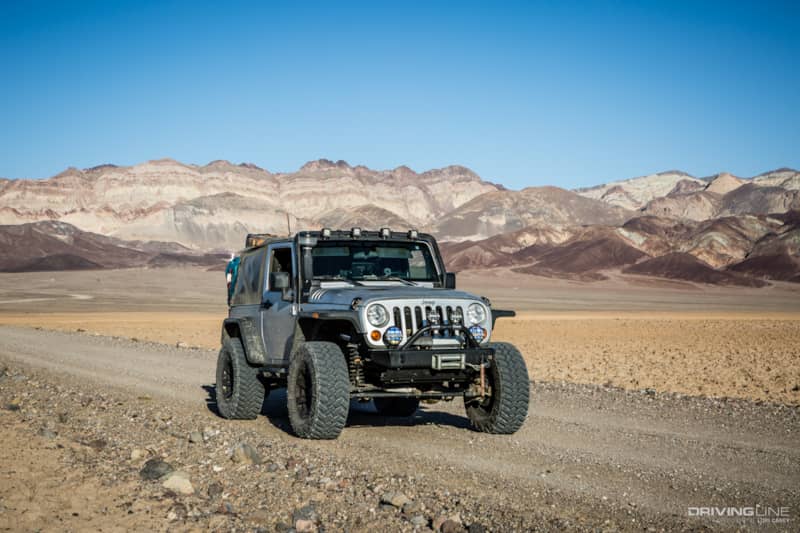
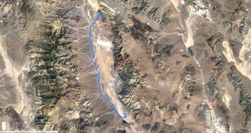
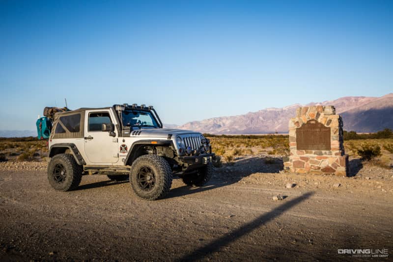
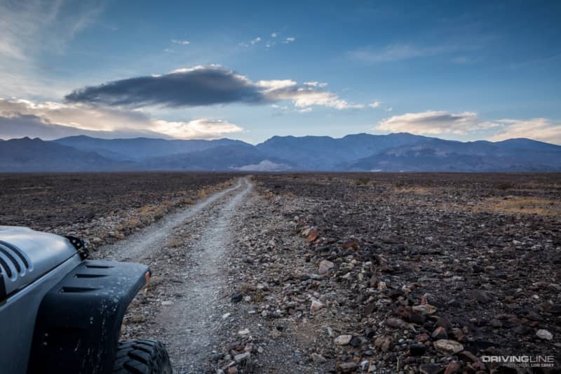
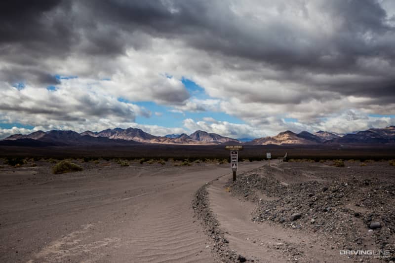
Death Valley West Side Road is perfect for those folks who want the experience of remote desert wilderness, but aren’t quite ready for the challenge of tougher terrain. When we read the description of the trail in our trail book, it sounded exactly like what we wanted: a 24-mile-long trail through a remote region of Death Valley with many historical sites along the way.
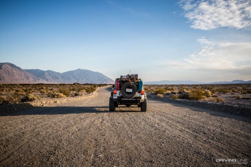
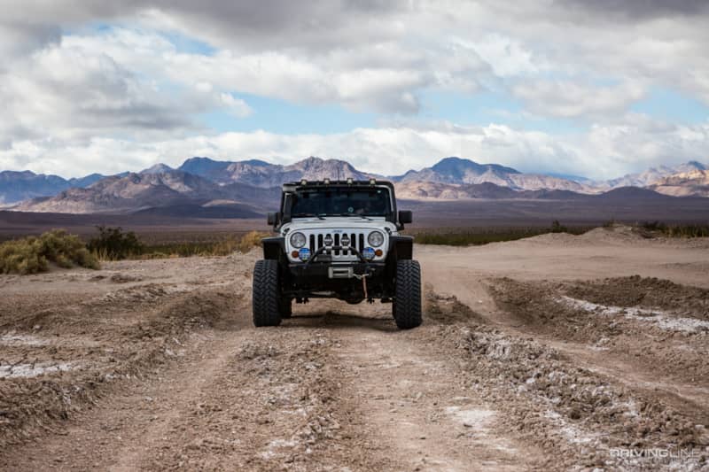
The truth is, if you are an experienced off-road adventurer, you will find it very tame and disappointing, but it does lead to several more challenging off-road trails in the Panamint Mountains, so it’s a good route to know. People who are new to going off pavement often describe the road as rougher and rockier than they had expected; but in a well-built rig, it feels like a super-highway.
We picked up the marked trailhead off Badwater Road (California 178), 6 miles south of the Furnace Creek Visitor Center. We were disappointed to find that it was really just a graded road, but we decided to hold off judgment until we had traveled a few miles and seen the sights. There was a good bit of washboarding; even grading doesn’t eliminate that.
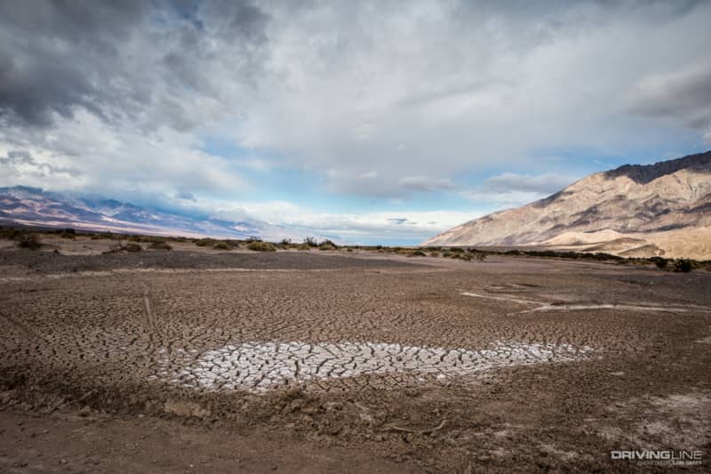
At mile 2 we crossed over Salt Creek, home to the Death Valley pupfish that lives nowhere else in the world. Several miles north in a different area of the park, there is an interpretive hiking trail and boardwalk where you can see the pupfish. At this end where Salt Creek used to flow into the ancient Lake Manly, it is usually dry.
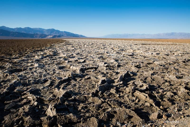
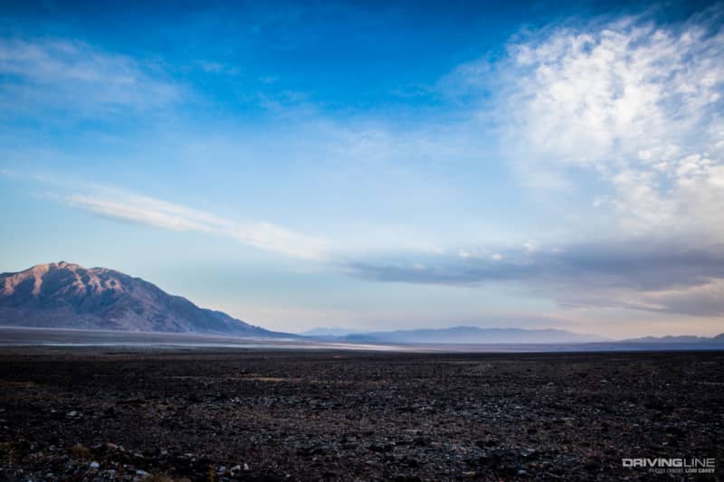
Lake Manly was created from glacial melt during the Ice Age. At one time it was more than 80 miles long and 160 feet deep, but it has been mostly dry for more than 10,000 years. The white crust is salt and borax crystals. On the other side of the trail is the famed Devil’s Golf Course.
Death Valley West Side runs roughly parallel to Badwater Road, on the opposite side of Badwater Basin. Badwater Basin is the lowest point in North America with an elevation of 282 feet below sea level.
The next point of interest was the remarkable Tule Spring — remarkable mainly because it is a great example of how pickleweed and other plants can grow in soil with salt content of approximately 15 percent.
Historical Points of Interest
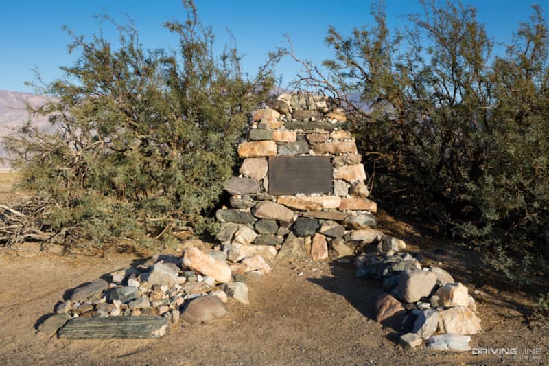
The gravesite of Frank "Shorty" Harris (described on the plaque as a “single blanket jackass prospector”) and Jim Dayton was our next stop. Harris was responsible for some of the most famous gold strikes in the area. His partner Dayton was buried where he died from exposure while making a supply run, and Harris asked to be buried next to him. Below the epitaph, the bottom of the plaque reads:
"To these trailmakers, whose courage matched the dangers of the land, this bit of Earth is dedicated forever."
We didn’t stop at Shorty’s Well. The pump has been removed and the pipe filled with gravel, so now it’s nothing more than a concrete square sitting in the desert. Eagle Borax Works was just a few piles of borax.
We were looking forward to seeing Bennett’s Long Camp because it was part of the Death Valley Escape Route followed by the Bennett and Arcan families that we wrote about in Death Valley Escape Route Over The Slate Range and Helter Skelter in Death Valley. There’s nothing to see now except a historical marker that tells the story.
We were feeling a bit ho-hum because the trail was nothing more than a graded dirt road and the sights (other than the spectacular landscape) were less than remarkable. If it’s your first time visiting this area, however, you may find it interesting. Seasoned explorers and off-roaders will probably find it boring.
A Storm Blows In
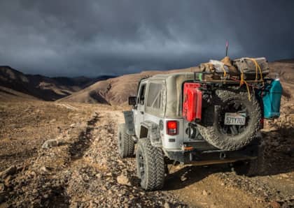
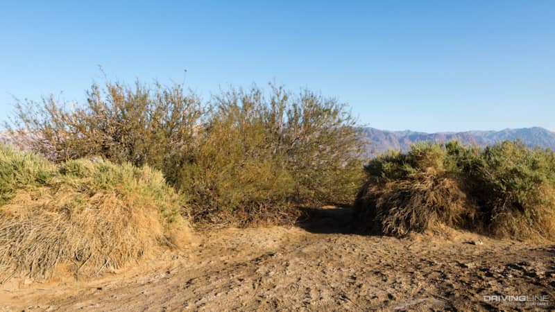
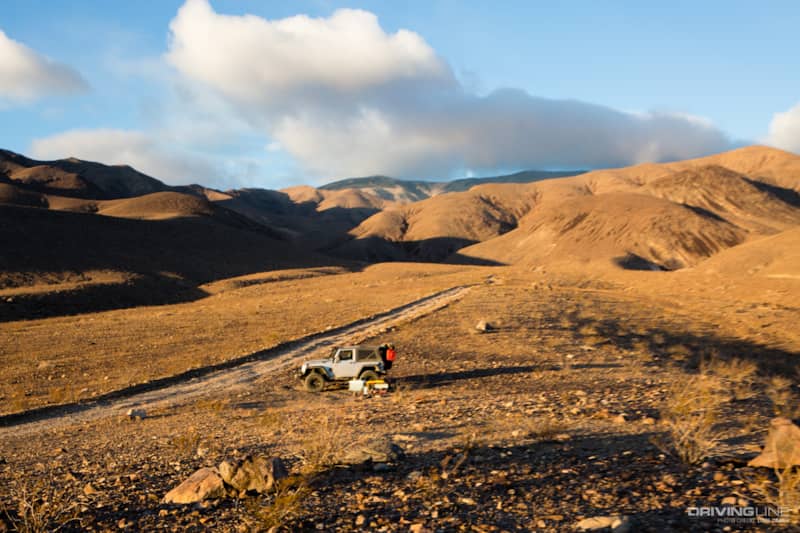
Even the tamest trail can bring trouble, especially in the remote Mojave Desert. Suddenly the sky turned dark, the wind started howling and down below we could see a sand storm raging in the valley. The Mojave is notorious for fierce winds, and as our Jeep was rocking back and forth, we decided to take a side trail and seek shelter at the base of the mountains.
Distances are deceiving in the desert; what looked like a mile would turn out to be 6. The trail that appeared deceptively mild was like driving over cobblestones, and the little rocks had us begging for mercy after only 2 miles as we rushed to beat the storm.
Flash floods are the biggest risk during desert storms. We found a flat spot on high ground and parked the Jeep. We had a great view of the storm raging in the valley all around us, but there was no shelter from the wind and no way we could set up a tent. The wind was blowing so hard that I could barely stay on my feet.
We had to spend an uncomfortable night sleeping in the Jeep. It was only 4:30 p.m. when we settled in for the long night. An hour later the sandstorm engulfed us, and we dozed on and off all night.
The morning brought a break in the storm and a peek of sun. Thankfully the wind had finally calmed, but the storm was still all around us.
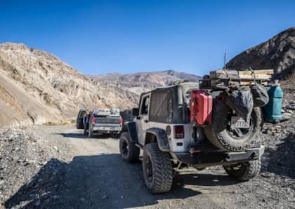
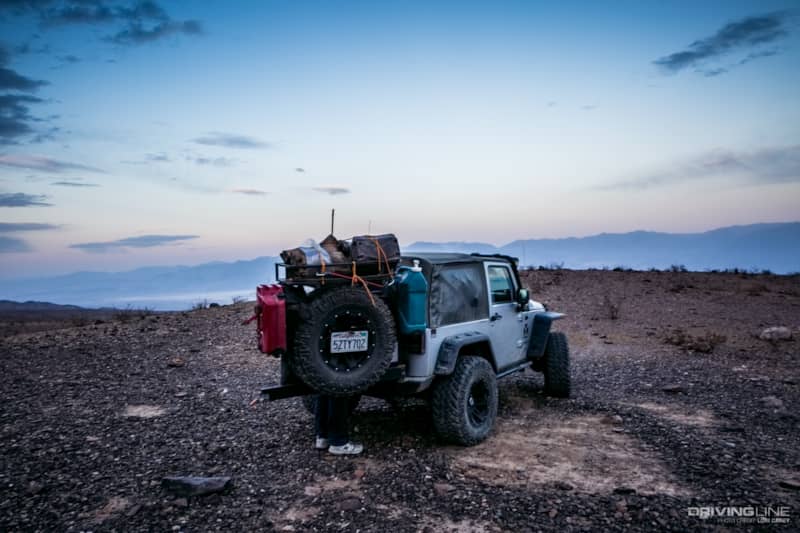
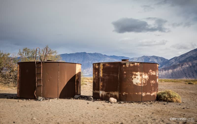
After a quick breakfast we got back on the trail, stopping first at the tanks at Salt Well and then passing the trail head for Warm Spring Canyon.
Warm Spring Trail is the rest of the Escape Route trail that will take you through Butte Valley. We had hoped to do the trail on this trip, but with the sky threatening to rain at any minute, we decided it would have to wait for another day.
The Amargosa River crossing was dry but can often be wet during the rainy season.
A few days later, the river was running so fast and high that it was impassable even for modified 4x4s, and the trail was closed to all traffic for several weeks.
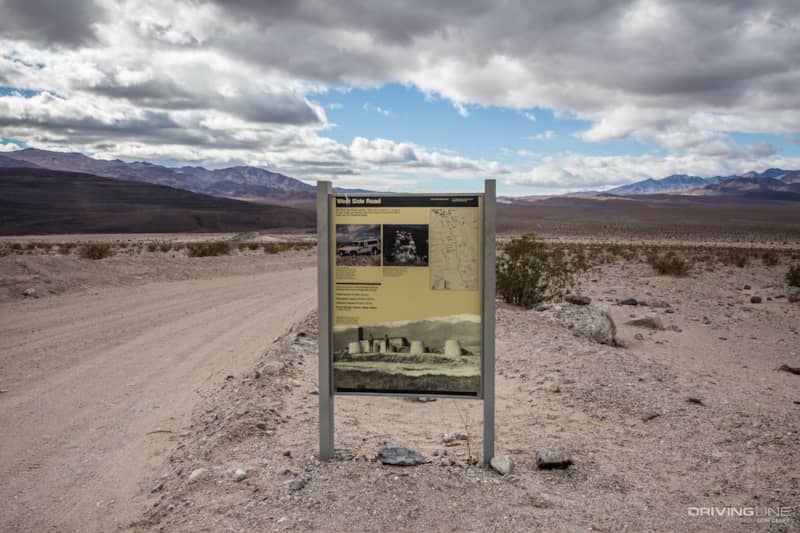
The trail ends on Badwater Road near Ashford Mills, 40 miles south of the Furnace Creek Visitor Center. There is a sign with interpretive information at this end. If you are heading out of the park and want to continue off pavement, you can pick up Harry Wade 2 miles down the road at Jubilee Pass and take it out to California 127, for another 30 miles of off-road exploring.
The takeaway: Just because a trail is super easy, there's no excuse for not being fully prepared for travel in a remote area of the desert. Sometimes, Mother Nature can throw you a curve ball.