Exploring Unmarked Trails in Alabama Hills
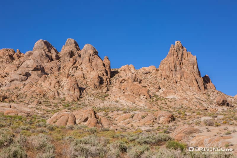
During my last trip to the Alabama Hills in the Eastern Sierra, I could not believe how crowded it was in the Movie Flats area just outside of Lone Pine, California. Hundreds of people were camping under every single rock formation, most of them boondocking RVs. Sadly, this is all most people know of the area, and few explore beyond the well-known and easily accessible sights listed in the guidebooks.
I bought my Jeep to get away from the crowds and I love seeing what I can find when I explore the tracks that most people never bother taking. There are hundreds of natural rock arches waiting to be found in the Alabama Hills — a few of the best-known are listed in guides and on maps, but you can find many more on your own if you take the time to explore. Many of the trails in this area have no name or number, so a sense of adventure is required, but none of trails are technical. They are fine for all SUVs with high clearance.
Escaping the Crowds of Movie Flats Area
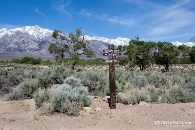
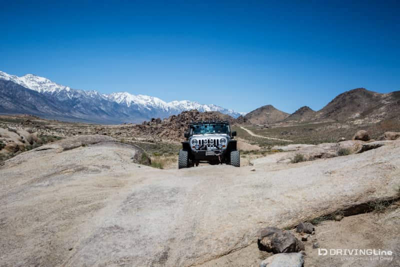
Following the graded-dirt Movie Road past all of the RVs and campers, we turned right onto an unnamed trail at the second Y intersection. Turning right again at the next intersection took us up into the hills overlooking the valley below.
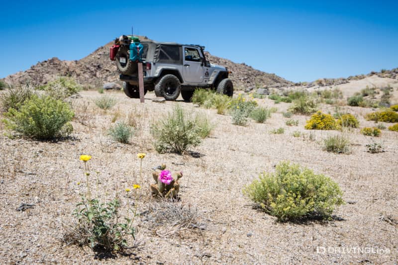
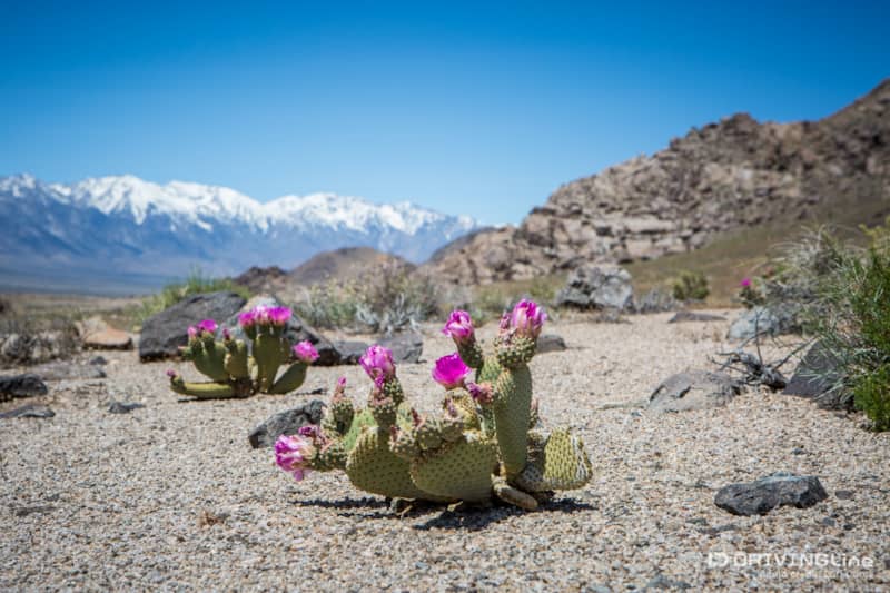
The trail begins as flat and easy-going sand. Even though it was late in the season, cacti and wildflowers were in full bloom everywhere we looked.
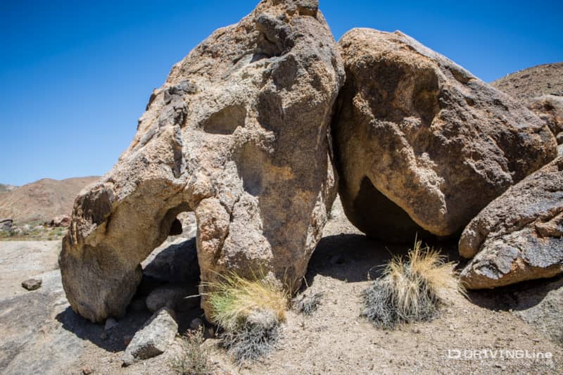
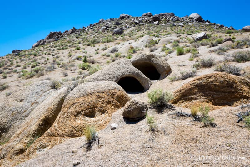
There are some unusual rock formations up here, and a few secluded campsites with fire rings. As crowded as it was down below, there wasn’t a soul in sight.
The trail crosses a huge slab of granite. The first time we came this way, the slab had a steep three foot ledge drop-off. Natural erosion has softened the descent now. It looks more intimidating than it is and it keeps away casual explorers who don’t have good vehicle clearance and the right tires.
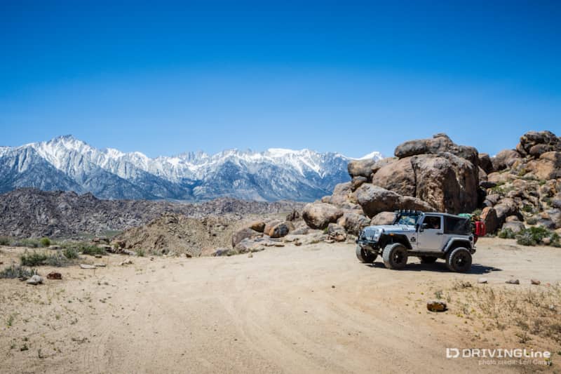
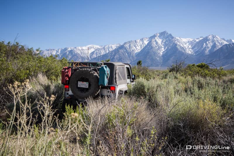
One of my favorite campsites is on this trail. Just on the edge of the cliff, directly across from Lone Pine Peak and Mt. Whitney, the highest peak in the contiguous United States. There is a fire ring nestled into the boulders, and the rocks make a good wind block. The view at dawn when the mountains are lit with alpenglow is hard to beat, and all of the RVs down below look like tiny specks.
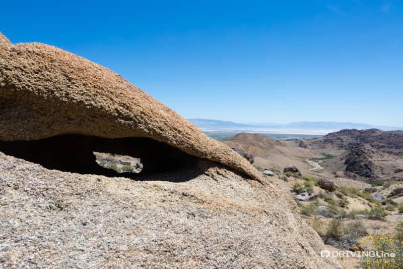
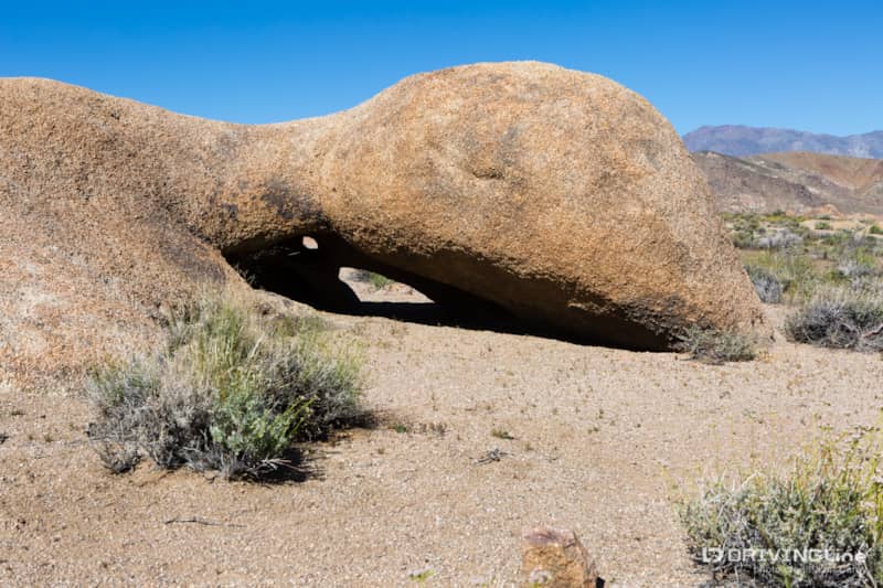
The trail dead ends a short distance past the campsite, and there is a hiking trail leading down into a valley. It doesn’t take much effort to reach this arch and a scenic view of Owens Dry Lake off in the distance, but the hike back up is very steep.
Retracing our steps, we spotted more interesting rock formations to check out.
Off-Roading Further on Hogback Creek Road
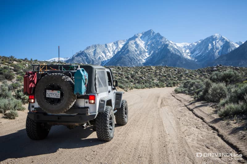
When we returned to Movie Road, we continued further north to Moffat Ranch Road and then turned on to Hogback Creek Road, one of the few named dirt roads in the area. We had no idea what we would find, but the trail headed toward the Sierra Mountains.
Another large natural rock arch looked like a nice spot to grab some shade.
The creek was running so fast at the water crossing that we got out to check the depth before going through. It only takes two feet of fast moving water to sweep away a vehicle the weight of my Jeep (and only one foot to sweep away the average passenger car). Only a few inches deep at this time, but as the snowpack melts and causes flooding in this area later in the season, make sure to check the depth of any fast moving water crossing.
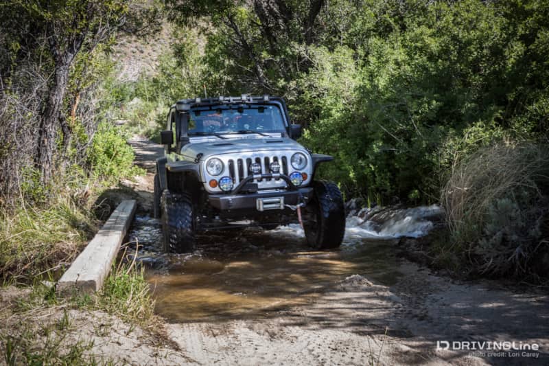
The trail stays close to the banks of the creek for awhile, creating cool, moist air. If it was a hot day, I’d be tempted to take off my boots and stick my feet in the creek.
Cattle graze in this area so there are some cattle gates. If you pass through a closed gate, be sure to close it behind you. The trail gets very narrow as it travels through the riparian area. Foliage crowded the edges of the trail, and it was impossible to avoid some “desert pinstriping.”
Joining Hogback Road again, the trail continues toward the mountains before the two roads fork near the base. At the intersection:
- Bearing right will follow the creek on 15S01 — Hogback Creek Road and a few short spur trails into Inyo National Forest abutting the John Muir Wilderness, where there are a few campsites tucked away.
- Staying left will put you on 14S04 — a wide and graded sandy road that ends at Whitney Portal Road. You can turn right and take the paved road up to Whitney Portal, the trailhead for the climb up Mt. Whitney. Turning left on Whitney Portal Road will take you back to the Alabama Hills and the city of Lone Pine, or you can cross over the paved road and explore the network of trails on the other side.
As we made our way back toward our camp, we spotted the famous Eye of Alabama arch off in the distance. Can you see it?
TIP: A few days after we returned home, a flood advisory was issued for the Eastern Sierra slopes due to increased snowmelt from the prolonged heatwave. If you plan to visit this area during snowmelt season, make sure you know where the streams and rivers are located, be sure to check for any advisories or watches, and always check the depth of any fast moving water crossings before proceeding.
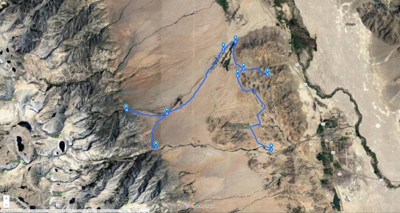
If you want to visit the Reward Mine and drive your Jeep into the tunnel, you can get there without driving on pavement. Head north on the un-named trail beyond Moffat Ranch. Keep heading north when it joins 14S03 and that will take you to the rear of Manzanar, directly across 395 from the Reward Mine trailhead.