Grapevine Canyon Trail- Anza-Borrego Desert State Park
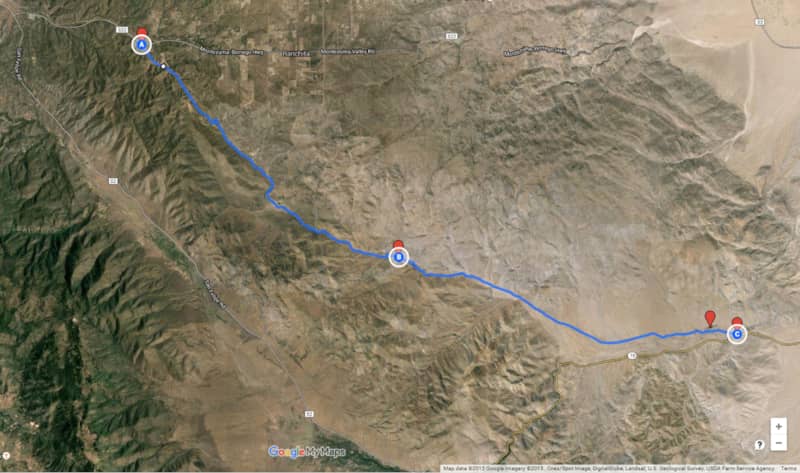
The Grapevine Canyon trail is a historic route that runs between the Volcan Mountains and the Grapevine Hills into the Anza-Borrego Desert State Park in southern California. The trail was once a main thoroughfare into Borrego Valley for horses and wagons in the days before Highway 78 and County Roads S-3 and S-22 were built. It descends 2500 feet from the mountains to the desert floor. The Pacific Crest Trail runs parallel to Grapevine Canyon a short distance to the west.
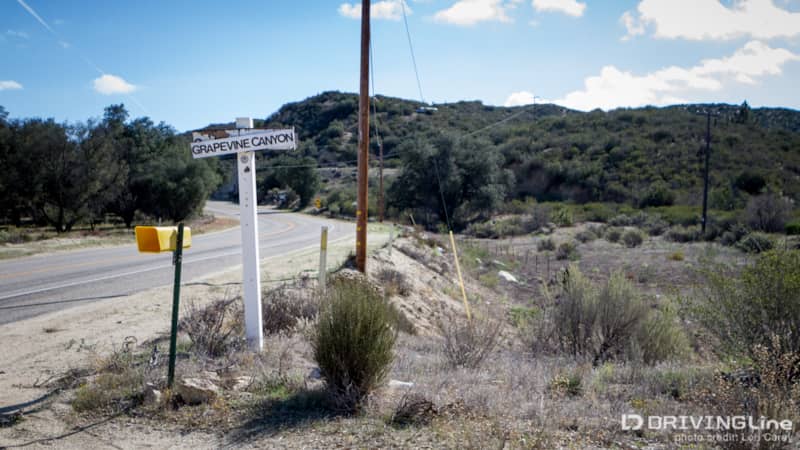
The 13.6-mile trail begins on Montezuma Valley Road/County Road S22. The trail begins on private property and the turn off is easy to miss because it looks like a private driveway. Look for this small white sign approximately 2.7 miles after the intersection with San Felipe Road/County Road S2. The trail travels through private property in Hoover Canyon for the first several miles. Please be respectful of those who live there. Always stay on the trail and keep your dust down. Don’t be surprised if you round a bend and find the locals target shooting with rifles (as we did!), they will stop shooting and wave as you go by. The road through this section is roughly graded and has some deep ruts.
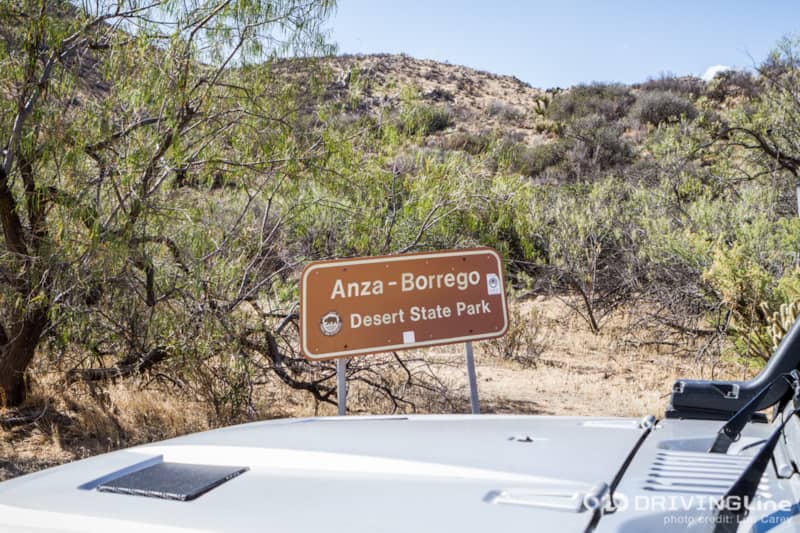
Once you are past the private properties, the trail will enter the sandy Grapevine Canyon wash. You will see a sign alerting you that are entering Anza-Borrego Desert State Park. There’s also a sign to let you know that you are about to cross into a sensitive archaeological area that holds special meaning for the descendants of the people who lived here in times past. The Kumeyaay Indians once inhabited this area, and many of their artifacts remain. It is illegal to disturb or remove historic or prehistoric sites and artifacts. So, if you are lucky enough to find anything, remember to leave it where you found it for the next person to enjoy.
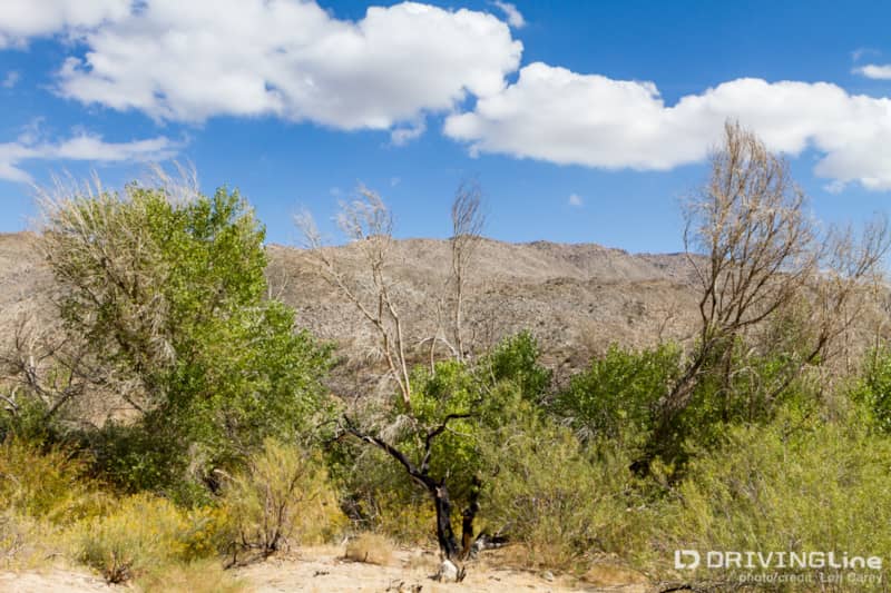
The trail passes along several springs, and I was happily surprised to find everything green and blooming this time of year. It doesn’t take much rain to bring life to the desert, and we imagine this would be a great location during a spring wildflower bloom. We drove past Stuart Spring, but when we reached the intersection, we decided to turn right for the short detour to the Angelina Spring Cultural Reserve. Angelina Spring was a strategic stopping point for desert travelers who needed water and the 437-acre Reserve contains many archaeologic and historic sites. There is a parking area at the end of the short spur road.
The air was alive with the sound of thousands of bees as we headed toward the oasis at the spring. Black-stem rabbitbrush was in full bloom and the yellow bushes were swarming with bees. The bees paid no attention to us as we walked through the overgrown path, but we did notice some big cat paw prints. Maybe it was just an excuse to avoid hiking in the 90+ degree heat, but we decided we didn’t need to venture any deeper.
There are no other interpretive signs here other than the one at the parking area, but we spotted a well-worn footpath and figured that it must lead to something worth seeing. We climbed up a small bank and soon spotted an area with several bedrock mortars, or morteros, in granite boulders.
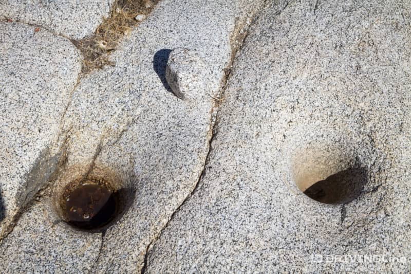
This was once the location of an Indian village, and the Indians would grind seeds and grains in the mortars. We even spotted a grinding stone, a lucky find since people often forget that it is illegal to remove such items.

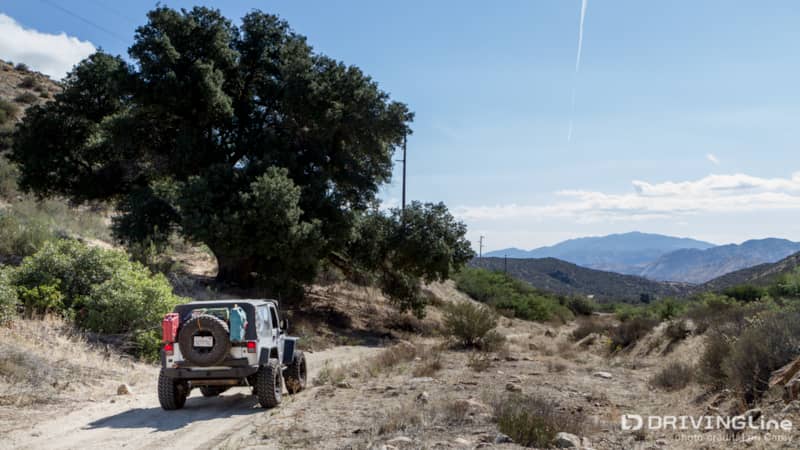
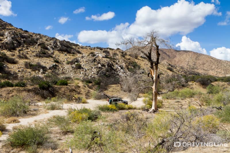
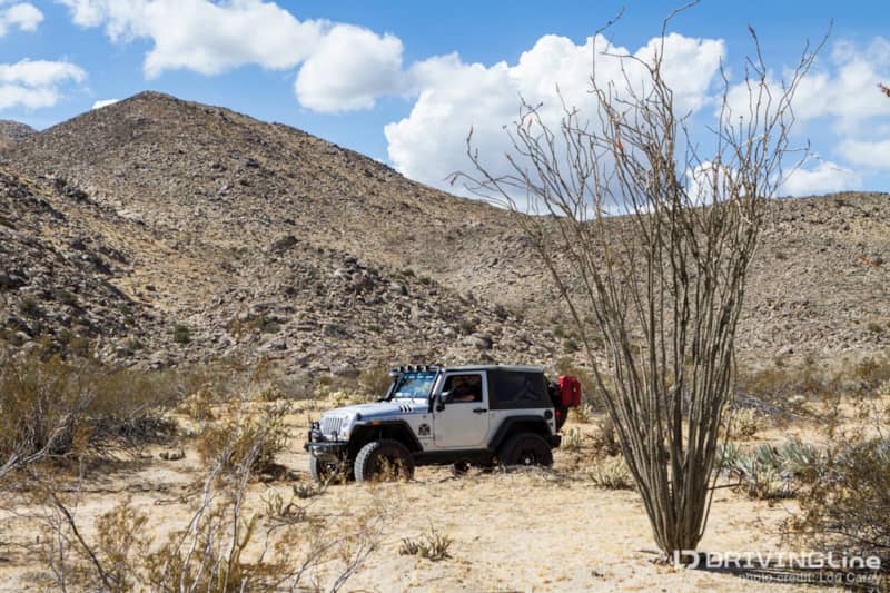
Back on Grapevine Canyon trail, the road became narrow and rocky. We had to shift into low range for one section. Although four-wheel drive isn’t required, we strongly suggest it. At the very least, you’ll need a high clearance vehicle. For a while, the trail became a shelf road with a steep drop on the passenger side, and we hoped we wouldn’t meet any on-coming traffic because there is no passing room.
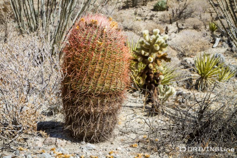
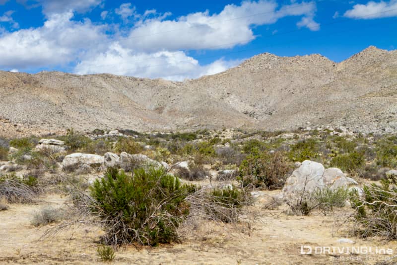
As we continued our descent, we noticed the amazing variety of cacti in this area. We spotted buckhorn, chain, teddy bear and pencil cholla, prickly-pear, beavertail, and barrel cacti of different shapes and sizes. The ocotillo and agave were blooming, and the views into the valley were spectacular.
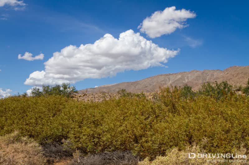
At the Y intersection, you can stay right to head out to California 78, or continue left through Yaqui Flat. The Flat is where the trail gets sandy and undulates through the bajada (an alluvial slope at the base of a mountain) as it follows San Felipe Creek to Yaqui Well.
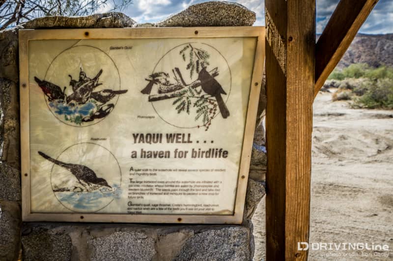
Yaqui Well isn’t a well at all, it is a seep. An oasis in the middle of the desert, it attracts many birds; more than 80 different species have been observed here and we were greeted with a loud chorus of birdsong and buzzing bees when we stepped out of the Jeep. Large desert ironwood and honey mesquite trees, draped with parasitic desert mistletoe, surround the seep. The mesquite trees were loaded heavy with pods and in full bloom. It was brutally hot at midday, and we bushwhacked our way through the dense, overgrown path that felt like a jungle, until we reached a sign that said the area is closed for restoration. The bees were too thick to argue with, so we returned to the Jeep disappointed that we didn’t make it all the way.
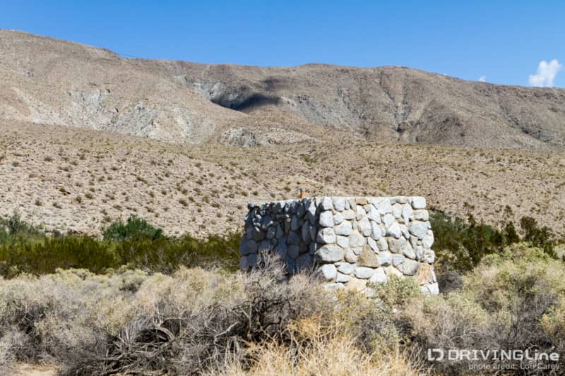
There is a primitive campground at Yaqui Well. There is no water or fire rings (fires must be in metal containers in Anza-Borrego), but there are outhouses. If you prefer more civilized accommodations, the Grapevine Canyon trail ends a half mile from Yaqui Well on Yaqui Pass Road (S3), just south of the Tamarisk Grove Campground. That campground has running water, flush toilets, showers, shaded picnic tables, and fire pits. Tent sites were $25 and adorable little cabins were $65 when we visited.