Scenic Sierras: The Bird Spring Pass Trail
This late in the season, we knew we would need to head north to the high desert to catch the last of the desert wildflower bloom. So, we flipped through some of our trail guide books in search of some new trails to explore. The BLM had been reporting that the blooms were still strong in the north Mojave desert, so we focused on Kern County where the Mojave meets the base of the Sierra Nevada mountain range. The promise of spectacular views along Bird Spring Pass caught our eye, and we loaded up the Jeep to check out the high desert trail.
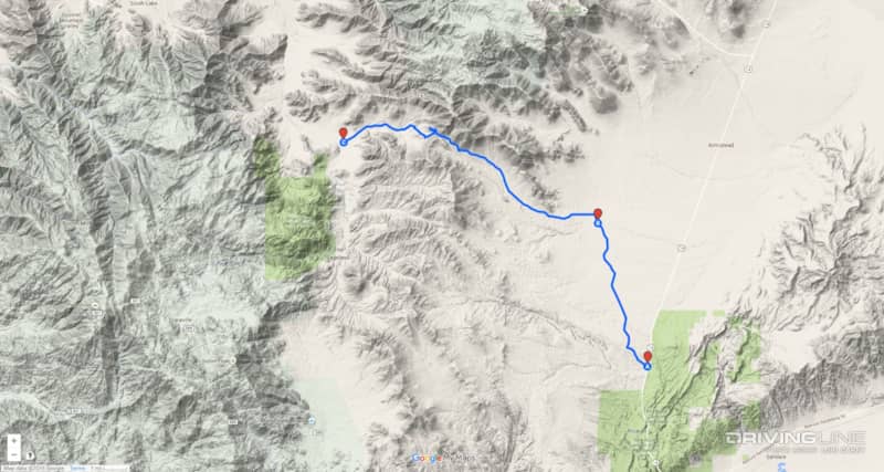
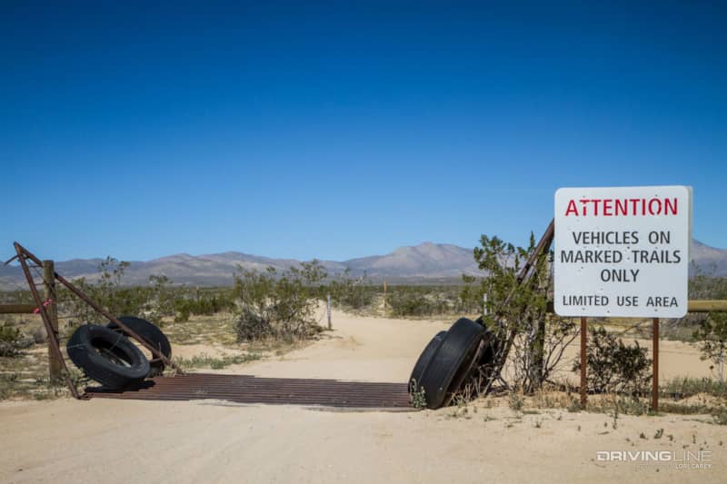
The trail begins at the Dove Springs OHV area off California 14, 3.5 miles north of Red Rock Canyon State Park’s Ricardo Campground. The main entrance to Dove Springs OHV area is SC103, and that will lead you directly to SC94. When you reach the four-way intersection with a large staging area, continue on SC94 as it passes through the gate over the cattle guard and leaves the open riding area.
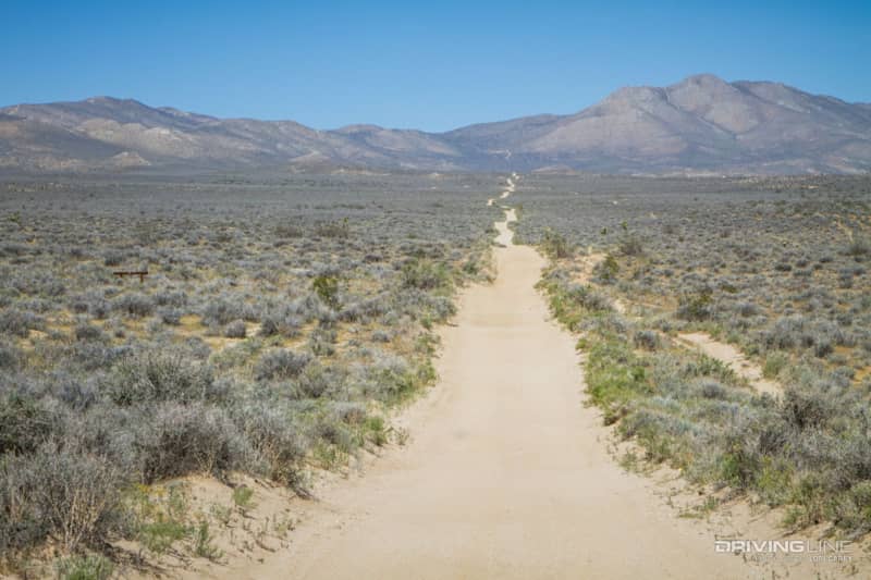
The 21 mile trail has a difficulty rating of 3 (out of 10) in Massey & Wilson’s Backcountry Adventures. The rating was given for the deep loose sand in sections of the trail, but there are also some rough and rocky sections that justify the rating. The beginning of the trail is well maintained as it travels through desert scrubland.
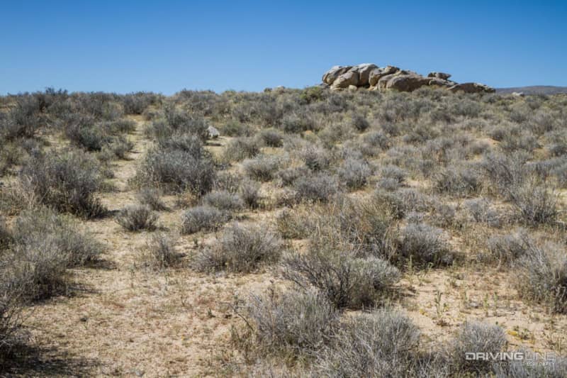
There are several interesting rock formations along this stretch of trail. When we spotted a path leading to one of the formations, we decided to stop and investigate. We were not sure if the path was made by animals or Indians, but we noticed what appeared to be caves for shelter. We were hoping to find some petroglyphs or morteros. We were being extra cautious watching for snakes sunning themselves, but we did not expect the overpowering whiff of skunk when we peeked inside one of the caves! We didn’t get sprayed, but it was obviously home to a skunk (even if he wasn’t home), so we decided that it was probably best to move on.

The scattered Joshua Trees were in various states of bloom at this elevation. Joshua trees are actually yuccas and they only grow in the Mojave Desert, typically at elevations between 2,000 and 6,000 feet.
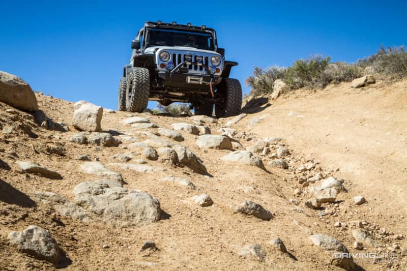
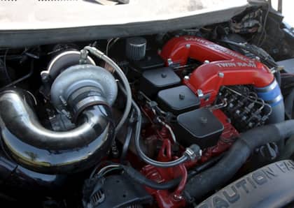
As we got closer to the mountains, the trail got rougher. There were several sections with rocks greater than six inches, and one off-camber steep descent. A high-clearance vehicle and tires with good traction are a must through here. Thankfully, our Nitto Trail Grapplers had no trouble absorbing the terrain.
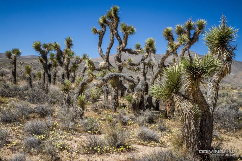
The trail then passes through a thick Joshua tree forest carpeted with tiny yellow flowers before it turns west at the boundary of the Kiavah Wilderness on SC120. It follows along the southern boundary of the Kiavah and the Owens Peak Wilderness areas for the rest of the trail. You can see that this road had been paved at one time; occasionally you can spot a section of old pavement.

The trail begins at an elevation of 2,600 feet and gradually climbs to 5,500 feet at Bird Spring Pass. At the top of the pass the trail crosses the Pacific Crest Trail, a 2,560 mile long-distance hiking trail that spans the western United States from Mexico to Canada through California, Oregon and Washington. To the left, there is a nice spot to have lunch in the shade just a few feet from the trail marker. When we visited, it was windy and chilly, so we decided to sit in the sun.

On the right, a short distance from the PCT trail marker, you can see where through-hikers cache water for their journey. People known as Trail Angels also drop off high energy snacks and treats for the hikers. The supplies can save a life, so please don’t disturb them. If you’re feeling generous, leave some water or snacks to put a smile on someone’s face.
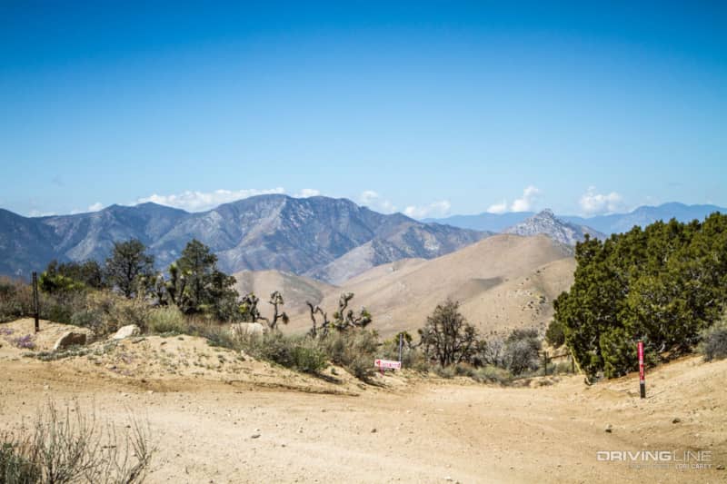
The view from up here is everything the guide book promised it would be- with even a peek of snow-capped mountains in the distance. It’s the perfect spot to get out and stretch your legs while enjoying the view. There is also a short spur trail to the south that climbs up to the communications towers on Wyleys Knob.
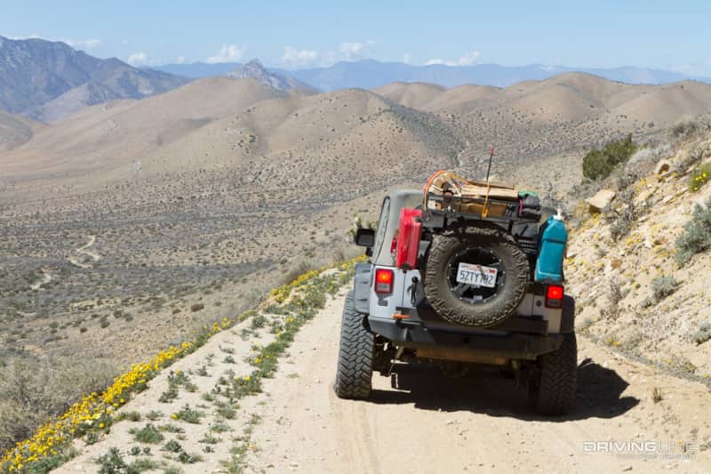
The next section made the entire trail worthwhile. The trail snakes along a very narrow shelf road with incredible views. It’s especially pretty this time of year with wildflowers lining both sides of the trail. There is only room for one vehicle, so if you meet oncoming traffic someone is going to have to back up. To the south of the trail is the Jawbone-Butterbredt Area of Critical Environmental Concern. We sure do have a lot of land designations in California.

The trail ends on the paved Kelso Valley Road, 10.7 miles south of California 178. This end has a sign informing that the first known passage by white men over Bird Spring Pass was in 1854. Turning right will take you to the town of Weldon and California 178. If you turn left there are a few trails to choose from that will return you to the Dove Springs OHV area.