Staying on Track: Methods of Off-Road Navigation
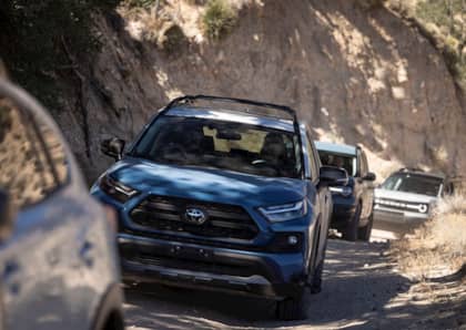
Adventure traveling is one of the fastest growing hobbies in the world. More people than ever before are leaving the buzz of city life and venturing off on paths less traveled, whether they are simple dirt roads to a campsite or grueling off-road excursions across hundreds of miles of wilderness. It’s reckless to leave home without the proper gear, tools and information to handle problems along the journey, and not having the right skills to navigate the outdoors can turn a fun weekend into a disaster. Here are a few of the most popular methods of navigating off-road, and why you should consider them before your next outing.
GPS System
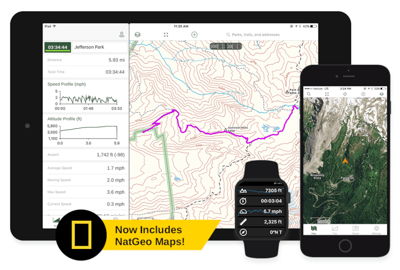
Starting off our list is the most commonly used method for navigating off-road: a GPS system. Global Positioning Sattelite, or GPS, devices became mainstream some 30 years ago, but have grown in functionality, reliability and user-friendliness in the years since. There are now a host of brands offering GPS devices geared towards the outdoor adventurist. While each has their own list of features to varying degrees, the principle is simple. It’s a device that has pre-loaded maps on it that tracks your location across those maps.
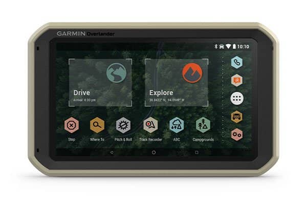
Additional functions of GPS devices like these include the ability to mark waypoints, such as your campsite, a ranger station, trailhead, landmarks or other features along your journey. Another useful function is creating tracks. Much like Hansel and Gretel left breadcrumbs through the forest to find their way home, creating tracks will draw a line on the map of where you have been so you can keep track of where you’ve traveled and how to get back to where you were. Additionally, these GPS devices can also measure point-to-point distances, and provide location information such as latitude, longitude and elevation.
Device App
These days, there’s an app for almost anything we as humans do. Mobile devices have completely taken over our lives, aiming to heighten our productivity, entertainment, communication and even our health. We rely on these devices for so much of what we do every day, and navigation is no exception. Of course, your phone likely has a built-in navigation app for city driving and simple navigating along road trips, but those apps are rather useless when it comes time to leave the pavement and cellular coverage area behind. So how do you navigate the vast expanses of wilderness with no cell signal?
Don’t worry, there’s another app for that. Recently, several off-road-oriented navigation apps have been released to aid you on your adventures. Leadnav and Gaia are some of the leaders in such apps, providing all the functionality of a dedicated GPS device on your phone. While these apps are useful to anyone venturing off the beaten path, they’re not all tailored to off-road driving.
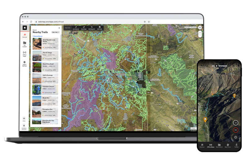
More recently, several apps have been surfacing that provide important trail information for off-road enthusiasts. The OnX Off-Road app is designed specifically with the off-roader in mind, providing much more than a run-of-the-mill GPS app. Some of the unique features of OnX Off-Road are trail difficulty ratings, photos, user-generated waypoints, weather conditions and the governing bodies of the land you’re driving on. This information, combined with offline maps and all the traditional tools of a dedicated GPS device, allows you to venture off the grid armed with the most up-to-date information about where you’re headed.
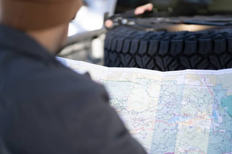
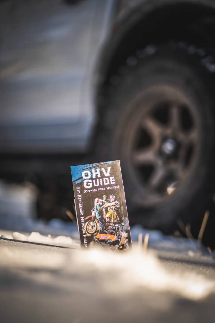
Traditional Maps
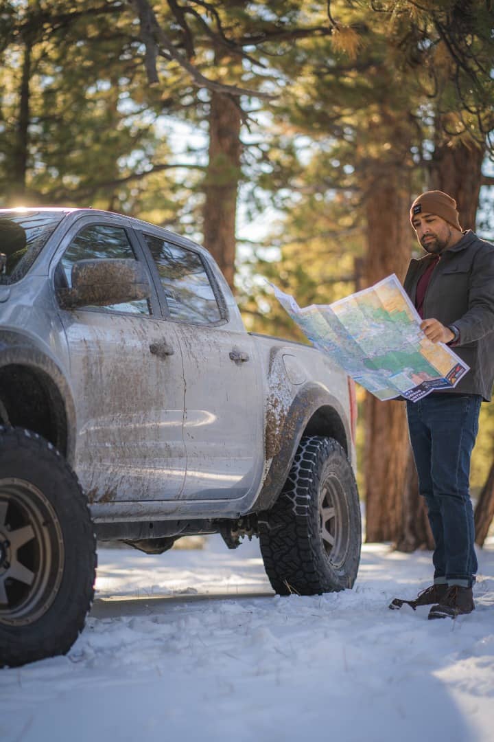
Maps have been absolutely vital tools for humans for thousands of years. Having a reference guide to keep us on the right path is the key to any successful journey, whether you’re driving across town to a new restaurant, or across the globe to unseen lands. Modern technology has changed the way we view and store maps, making them easier to use and infinitely more capable, but there’s something to be said about carrying a good old fashioned paper map of the region with you.
Let’s face it; technology isn’t always reliable. It depends on electricity or batteries to operate, can be affected by weather and requires a constant signal to work correctly. It’s important to have a contingency plan for unforeseen circumstances when you can’t rely on your tech. The beauty of a paper map is in its simplicity. Most well-drawn maps contain topographical information, are well-labeled and contain a key to decipher paved roads, unpaved routes and hiking trails. While not as convenient as a GPS or your mobile device, you can find paper maps for nearly any region, and most state and national parks have them on hand at local ranger stations or welcome centers. Grabbing one of these paper maps and sticking it in your glovebox is a great backup for when technology fails.
Additional Devices
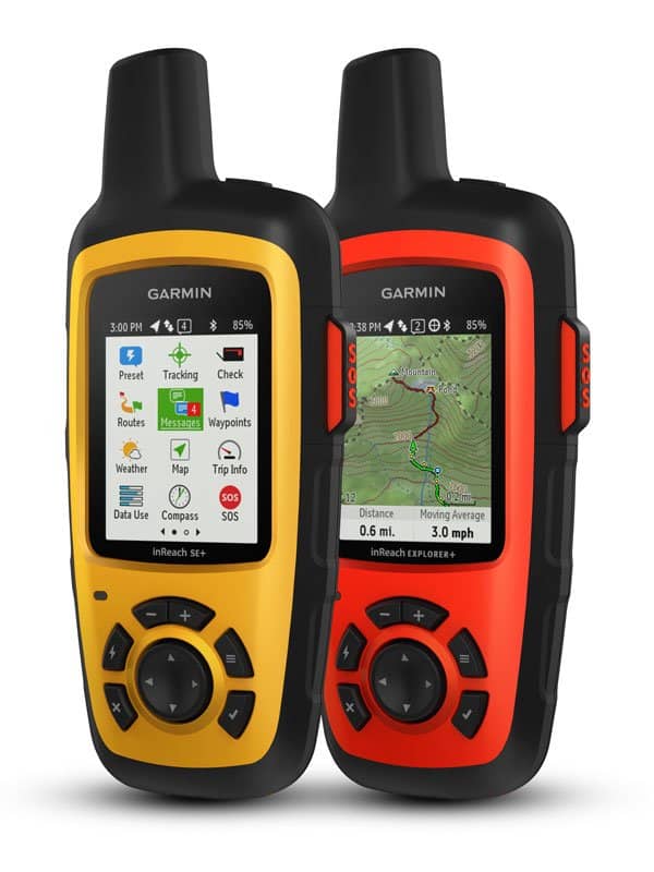
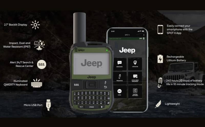
As an honorable mention, we’d like to include emergency beacons in our list. While not traditionally used as navigation devices, these emergency beacons have a direct satellite signal that allows you to send messages to loved ones, authorities or search and rescue operators in the event of an emergency. They have the ability to send messages to pre-determined phone numbers, giving location information as well as pinging your current location at pre-determined intervals. While these devices aren’t cheap, and require a data plan subscription to operate, we believe them to be invaluable in the case of a real emergency where outside assistance is needed.
Whichever navigation method you choose, having a plan and telling your friends and loved ones what that plan consists of is the most important preparation you can make before any trip. Tell them where you’re going, who you’ll be with, how long you’ll be gone and when it’s time to start worrying. Getting lost isn’t the end of the world, but it can present much bigger problems that can be life threatening, such as running out of fuel, food or water. Having a foolproof navigation plan, and a backup for it, can mean the difference between a fun weekend away from home, and a serious emergency. So plan ahead, learn how to use your gear, have fun and be safe on the trail!
More From Driving Line
- Here are some of the best off-road trails in the U.S. where you can use your navigation skills to have a great weekend.