Stranger Than Fiction: The Trona Pinnacles
Science Fiction fans will enjoy visiting the strange geological features of the Trona Pinnacles, located some 20 miles east of Ridgecrest in the Mojave Desert. The surreal landscape has been used to shoot many space movies, including Planet of the Apes, Star Trek V: The Final Frontier, Battlestar Gallactica, Dinosaur, the remake of Land of the Lost, and the television series Lost in Space. Conspiracy buffs speculate that the Pinnacles were the actual site of the moon landing.
We’ve visited the Pinnacles to photograph them many times, usually on our way home from Death Valley, via the easy four mile trail off of California 178. Our trail book shows that the trail continues for another twenty miles west beyond the Pinnacles, and we wanted to explore the full length.

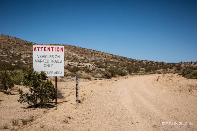
The easiest way to pick up the trail from the west is at RM143 off Trona Road a few miles south of the intersection with Searles Station Cutoff. Our trail guidebook suggested a different route and told us to look for an unmarked trail further south designated as C2, also known as Savoy Road. In this region of the Mojave, the letters preceding the trail number designate which land management section a trail lies in – RM is Red Mountain, R is Randsburg, and C is China Lake. It’s important to know that many of the trails in the western Mojave have recently been renumbered to fit this alignment. The trail referenced in the guide book is no longer C2, as the China Lake section lies to the northeast of the Red Mountain section. It can be confusing when you are looking for a trail number that no longer exists.
At the designated mileage, we turned onto an unmarked trail that showed on the GPS as Savoy Road and on the map as 258 (no letters!). Still following the guidebook, we turned onto RM7A. For anyone who intends to visit the Pinnacles, it’s important to note that the correct trail is now designated RM7. A different trail is now designated 7A and it is passable to a point, but it doesn’t go where you want to go. You’ll also have to do some open desert navigating to get back on track.
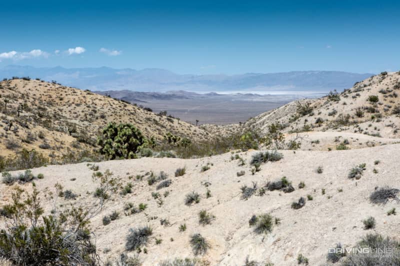
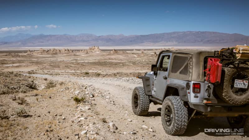
The views of the dry Searles Lake Bed were spectacular.
We realized that RM7A wasn’t the correct route when our Friends of Jawbone trail map showed that there was a long section of 7A coming up that was only wide enough for bikes and ATV’s. We needed a bailout point, and 265 heading north was our last chance. The trailhead was deceiving because it looked like a wide and sandy track.
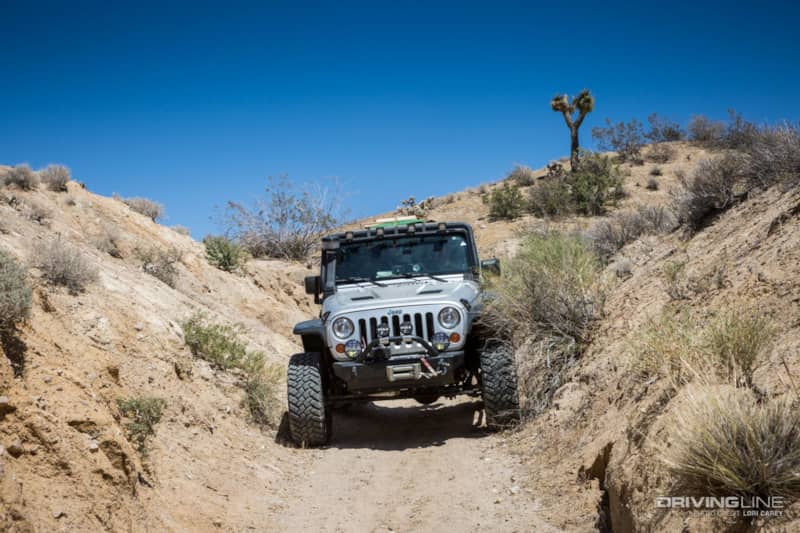
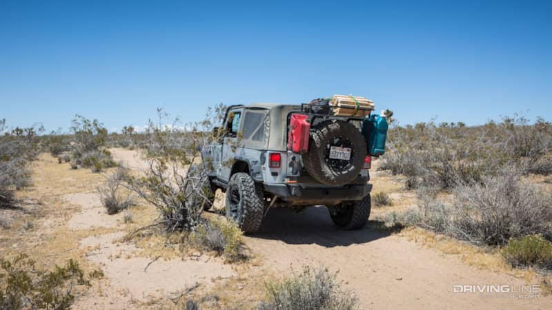
In less than a mile, the trail got very narrow as it wound its way down the mountain. If you go this way, you can’t avoid a lot of desert pin striping. The trail is just barely wide enough for a Jeep, as long as you don’t mind straddling it once in a while. The desert can be especially hard on tires. Thankfully, our Nitto Trail Grapplers are more than up to the task.
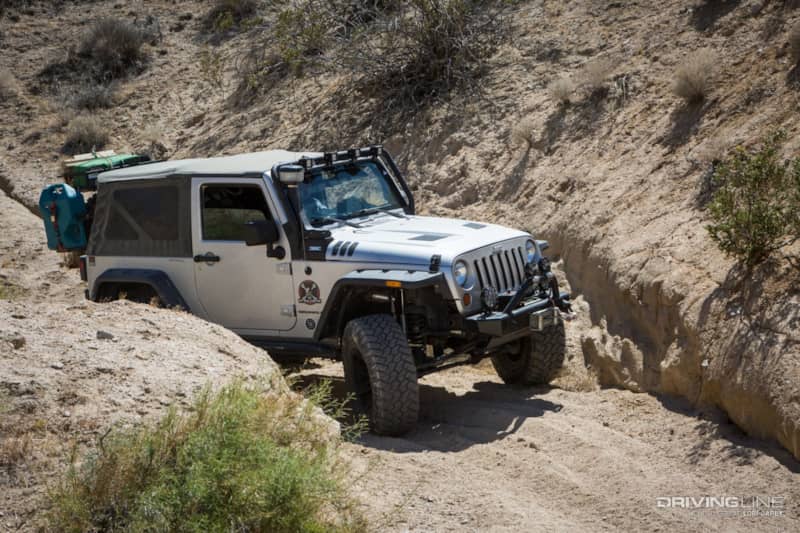
The trail stays in a deep drainage channel all the way down to the valley. The sand is deep and loose, and some spots have significant erosion. There are a few tight turns; a full-sized rig would have a hard time here.
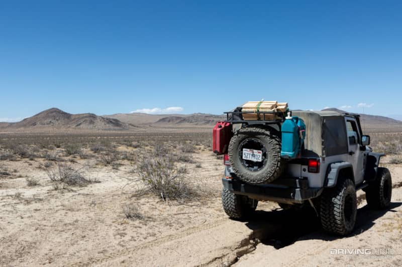
We reached the valley in the Spangler Hills open riding area. Open riding areas are a vast network of crisscrossing trails. It’s just a matter of working your way in the direction you need to go, but most of the trails are better suited for ATVs and bikes. We could see the Searles Lakebed in the distance and knew which direction we needed to head. But, we ended up on a trail that felt like an endless rollercoaster. It was a huge relief when we finally reached RM143, the main trail to the Pinnacles.
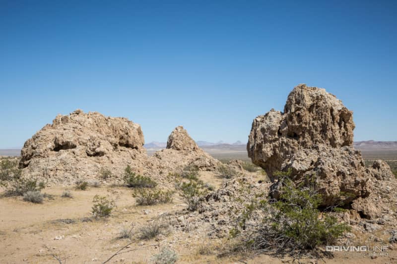
After 13.7 miles, we crossed the paved Navy Road. The private road is for military use only and leads to China Lake Naval Weapons Center. On the other side of Navy Road is the Trona Pinnacles National Natural Landmark. It wasn’t long before we spotted some tufa formations, but these aren’t the main attraction.
Off in the distance were the main groupings of Pinnacles. More than 500 tufa spires rise from the dry Searles Lake Bed, some as tall as 140 feet high. The strange formations are primarily made of calcium carbonate and were created 10,000 to 100,000 years ago when this area was under water.
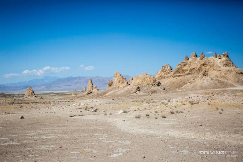
There are three main groupings. These are known as the northern, middle, and southern groups, each formed during a different ice age.
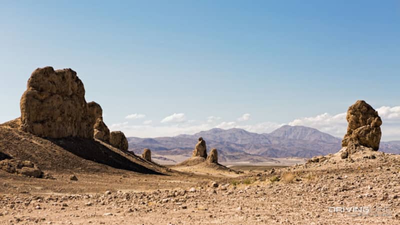
The pinnacles are classified according to their height and shape. Towers are taller than they are wide, tombstones are short and stubby, ridges are massive formations with toothy spires, and cones are less than ten feet high.
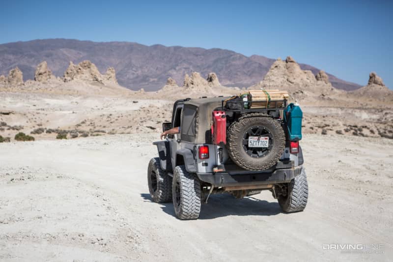
There is a graded dirt road through the main group of Pinnacles, and a vast network of trails throughout the area. Four-wheel drive is recommended for traveling off the graded road because the washes are very sandy. There is a vault toilet near the main group, but no other services here.It’s easy to see why this location was used as the backdrop for outer space movies. We didn’t see a single person the whole time we were here, but on holiday weekends it can get crowded around the main grouping because there are many access trails from nearby OHV areas.
Primitive camping is permitted at the Pinnacles and there are some really nice spots further out from the main group. Our original plan was to camp here overnight so we could photograph the pinnacles at sunset and do some night photography. Unfortunately, the wind was really blowing. We could hardly stand up straight and opening the Jeep doors was almost impossible. After scouting around for an hour and hoping the wind would die down, we decided that there was no place that offered enough shelter to set up a tent in such strong winds. We were disappointed because the Pinnacles are spectacular in the late-day light. We got back on the main trail and headed out in search of a better location.
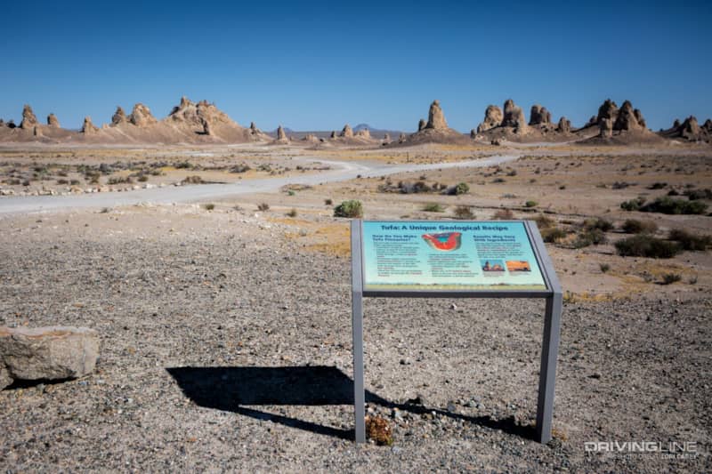
The trail from the main grouping of Pinnacles out to California 178 is four miles of graded, easy trail. There is a stop along the way with several interpretive signs and a scenic view of the main grouping. The trail ends on California 178, 1.8 miles south of Trona. Nearest services are in Trona and Ridgecrest. Temperatures regularly exceed 120 degrees during the summer, so the best time to visit is in the fall through the spring.
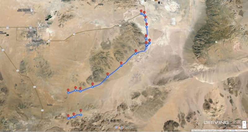
This map shows the trail we recommend you take, RM143/Pinnacle Road straight through. The short marked section to the south is the route we took starting on Savoy Road that we don’t recommend unless you are the adventurous type who is comfortable with navigating through rough open desert terrain. We couldn’t mark the entire length of it because Google Maps didn’t recognize the paths as valid trails, even though they were properly designated open trails. The route we took added an extra 3 miles to the trip, for a total of 27 miles.