Surviving The Nadeau Trail

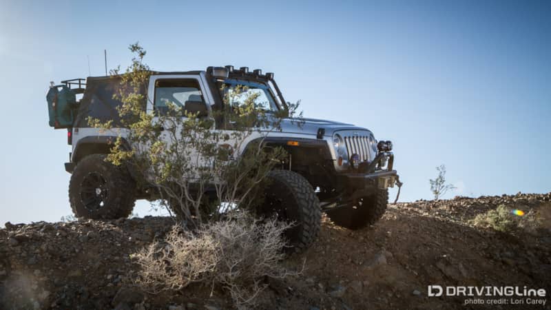
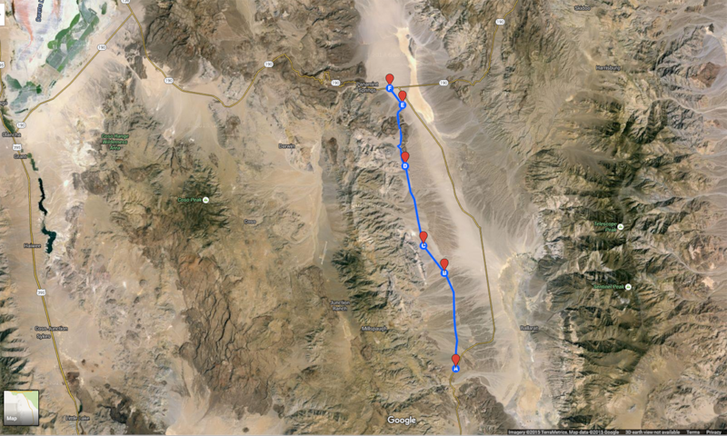
We’ve wanted check out the Nadeau Trail in Darwin, California, since it was first designated as a National Recreation Trail in 2013. The 28-mile trail runs through the Panamint Valley in the Mojave Desert, flanked by the Argus Range to the west and the Panamint Range to the east. The trail is named for Remi Nadeau, a French-Canadian pioneer who ran a teamster operation of 20 mule teams in the 1800s. It was the main corridor for Nadeau’s freight wagons to carry silver from the Cerro Gordo region down to Los Angeles and bring supplies back to the mining camps. There are numerous four-wheel drive and hiking trails off the main route that provide access to steep mountain slopes and deep canyons. There are also many ghost towns, mining camps, and archaeological sites along its length. Most of these sites are in excellent condition and remain largely the same as they were in the 1880s. You may be familiar with some of the area trails if you have ever attended Panamint Valley Days hosted by Cal4Wheel.
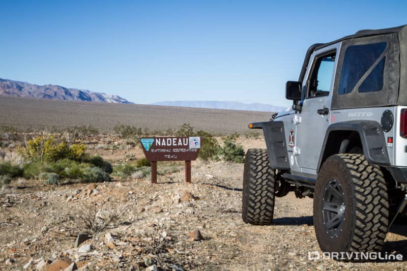
There isn’t much info available on line about the trail, and maps show the nearby paved Nadeau Road, not the trail. It took a bit of research before we were able to find coordinates for the trailhead (35.996884 -117.337234), and we realized that Google Maps shows the southern portion of the trail as “Hadue”. Google Maps also incorrectly labels a long section of Highway 190 as “Nadeau Trail”. The correct trail is officially marked P105.
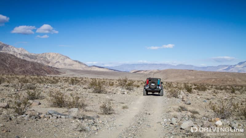
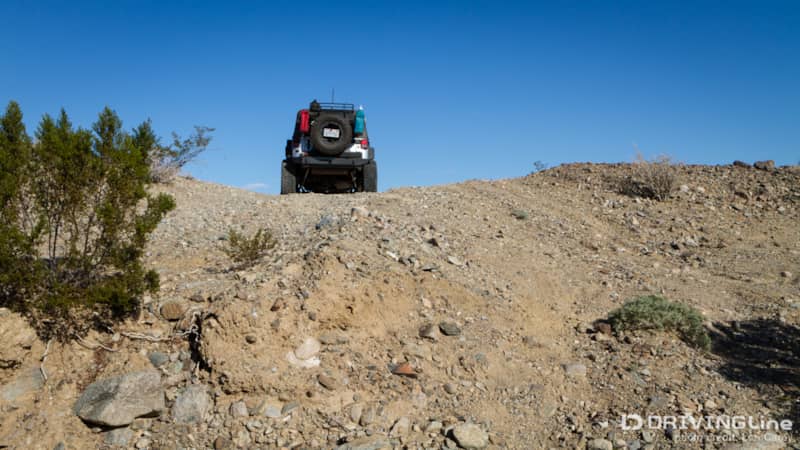
The plan to was pre-run the trail, and then do some exploring on the return. That didn’t work out quite the way we planned. We were pleasantly surprised to find that the trail was rougher than we had anticipated, at least for the first five miles.
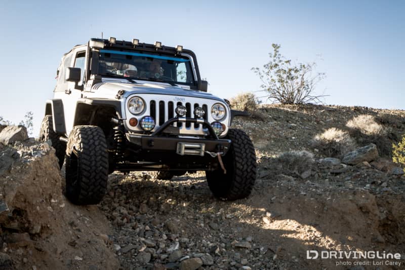
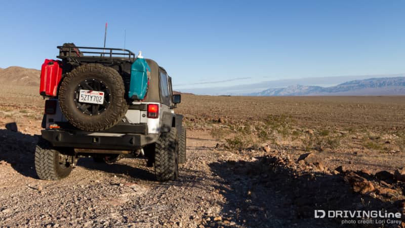
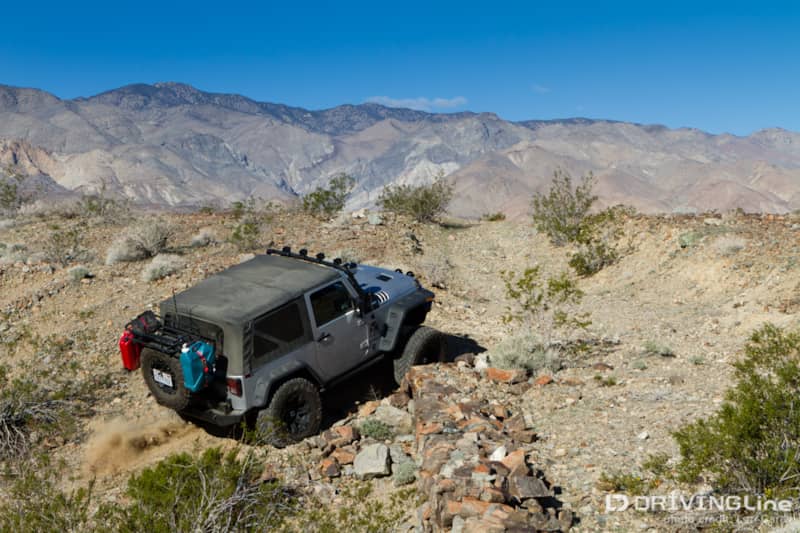
Because the trail sits in the valley between two mountain ranges, getting through the valley means crossing washes, one after another, after another.
The area had some extremely heavy rains in October and entire sections of the trail had been completely washed out. Some of the washes were more like huge cracks in the surface of the earth than the typical desert wash. It was slow going.
We were only a mile in when we reached a gaping fissure with no obvious way across. We could see the tire tracks where the last person had crossed, and where the bank collapsed underneath the passenger side. We got out to look and realized that just our body weight was enough for the bank to continue collapsing. The photo doesn’t do it justice, but the trench was about four-feet deep and we knew that letting one side of the Jeep drop into the hole, especially if the bank suddenly collapsed beneath us, would be trouble. Trouble that we didn’t want when we were on our own with anyone else to help. After staring at it for a few minutes and continuing to search for a stable place to cross, we did the only thing we could think – we stacked rocks to two feet high where the passenger side tires would land and then held our breath as we cautiously dropped over the edge of the bank and made our way across.
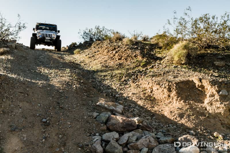
It wasn’t long before we came to the next washed out section, and it was a doozy. Obviously, this section has been long gone! The closure was well marked with rocks across the trail and we found a bypass not far to the left of the trail.
The bypass required going to the top of a small hill and descending almost straight down into the wash before climbing out.
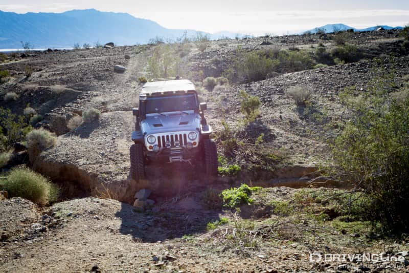
After five miles of navigating the rocky, rutted trails and crossing an endless number of steep washes, we reached the paved Nadeau Road. We made a left on the paved road and went 2.8 miles, then turned right at the Nadeau Trail and P105 trail signs to pick up the trail again.
There was only one more washed out section on this side. It was clearly marked with rocks across the trail and the bypass was just to the right.
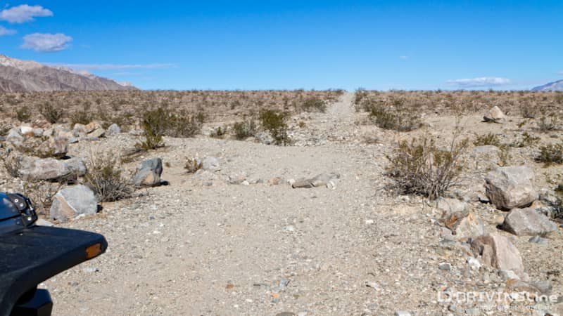
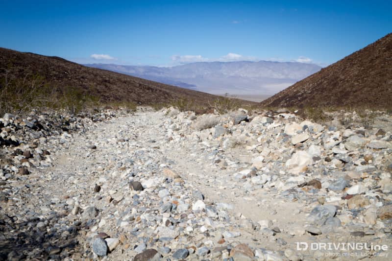
The trail was much easier going on this side of the road. It is your typical unmaintained rough and rocky desert trail.
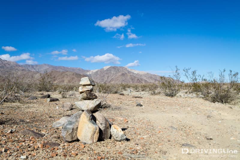
The trail is well marked with cairns, until it enters the rocky riverbed where there is no clear trail. Like most riverbeds, the terrain changes after every rain. Just follow your instincts as you pick your way through the rocks and plants, and keep an eye out for a cairn where you exit the riverbed.
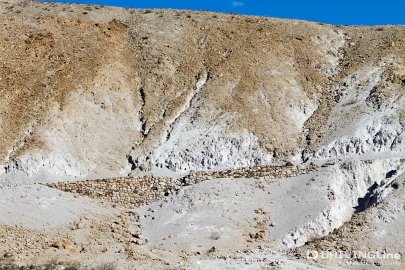
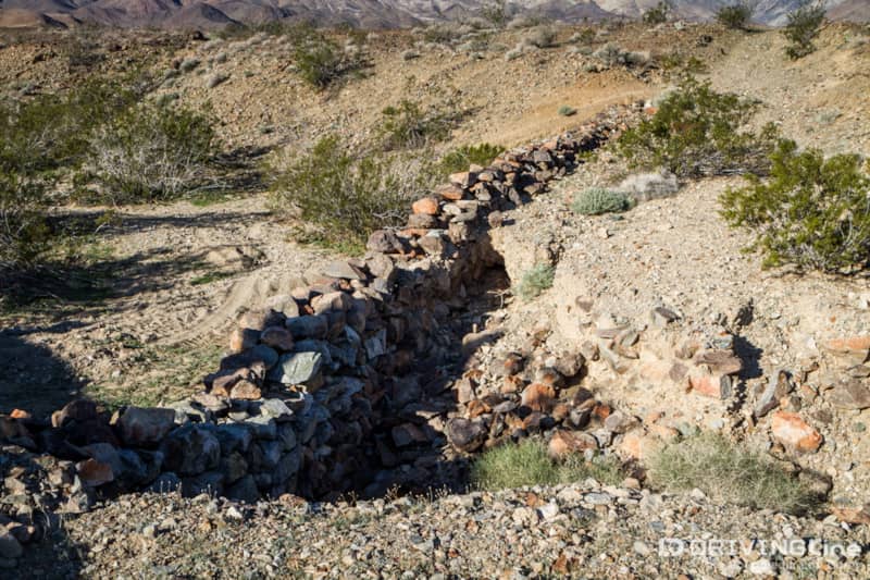
Chinese laborers played a large part in road building in this rough terrain during the heyday of the mining era, and you can see some examples of their work along the way.
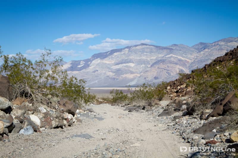
The views from this end of the trail are spectacular. Most of the offshoot trails to ghost towns and old mining camps that people may be familiar with are on this end, including Defense Mine, Lookout City, Minnietta Mine, Stone Canyon and Osborne Cabin. Since this end of the trail sees more traffic, it is in much better shape than the southern end.
It was early afternoon when we reached Highway 190, where the trail ends. We realized that our plan of running the trail out and back wasn’t going to work, there weren’t enough hours of daylight this time of year and neither of us liked the idea of traveling on the rough southern end in the dark without another vehicle along. It had taken us close to five hours to make it this far. The main slowdown was the rock stacking we had to do at the one crossing. It was a cold and windy day, and after spending much of our time out in the weather, we were ready for a break.
We needed gas and a run into Panamint Springs was in order, so we agreed that Plan B would be lunch at the only restaurant in town (we highly recommend the pizza, which was surprising good!). From Panamint Springs it was just a quick shot back up 190 to pick up Trona-Wildrose Road, which took us back to the start of the trail and just a few miles from our base camp.
If you go, make sure to gas up at Trona before reaching the trailhead. The only gas stations in this area are in Trona and Panamint Springs. Panamint Valley is just outside of Death Valley National Park. It is BLM land, which means camping is allowed anywhere, but please practice common trail etiquette – whenever possible make camp in locations where others have camped previously, and use existing fire rings. There are no services out here; all camping is primitive dry camping.