Last Ride For 2015-The Bendire Canyon Trail
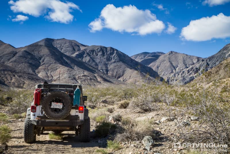
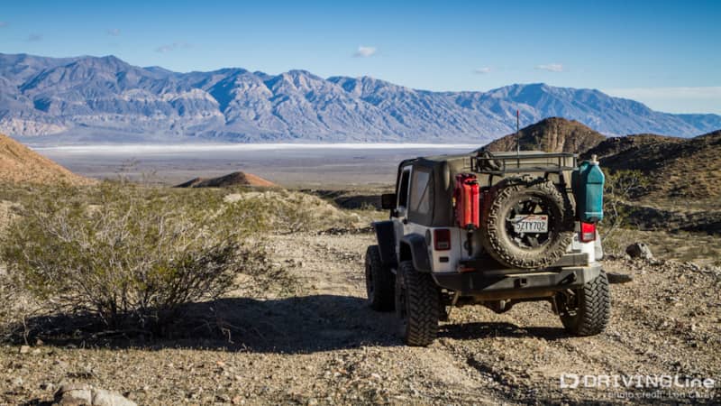
Bendire Canyon may not be the best-known Jeep trail in Panamint Valley, but it certainly is one of the prettiest. The trail is not enough of a challenge to attract the attention of the hardcore ‘wheeling enthusiasts, but it’s too rough and remote for most casual off-pavement adventurers. We couldn’t stop saying “Wow!” the entire length of the trail. In fact, we when we found it to be one of our favorite trails of the year.
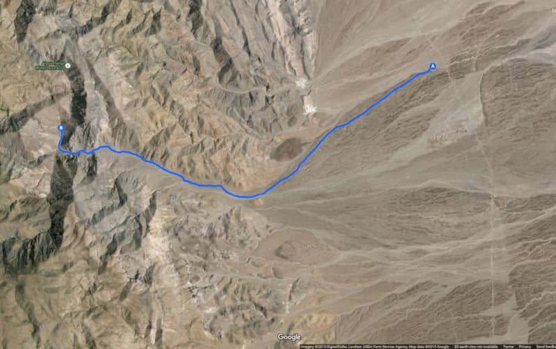
There are three trails off the Nadeau Trail, or the nearby paved Nadeau Road, that will lead you to the main trail into Bendire Canyon. If you take the trail that begins at 36.1091185° -117.353837°, you can stop to see the Panamint Valley Crater at 36.0979032° -117.3767135°. No one really knows what caused the impact crater and there are many theories. There is an 88 foot vertical shaft in the center of the crater, so if you visit it, please be careful.
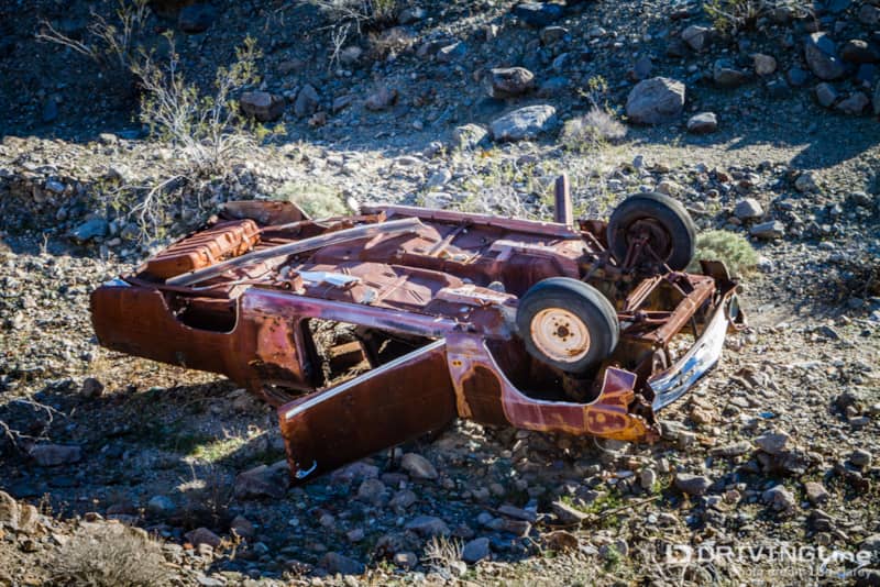
For a few miles, the trail rides atop a narrow berm in a desert wash, with steep drop-offs on either side. A car at the bottom on one side is a good reminder to pay attention.
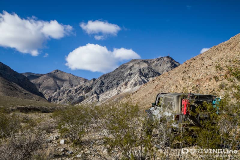
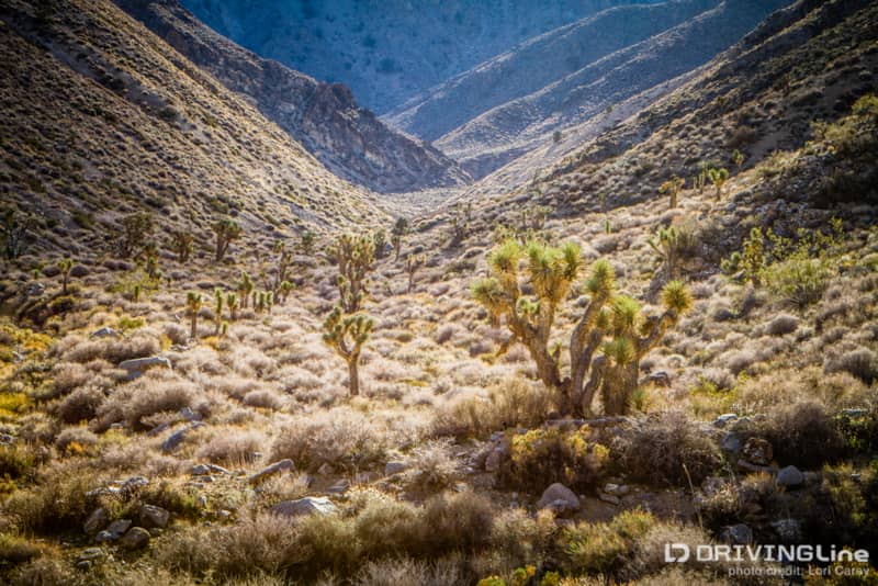
As you approach the mountains of the Argus Range, the trail becomes very rocky. It drops down into wash, where it will remain for most of the climb up through the canyon.
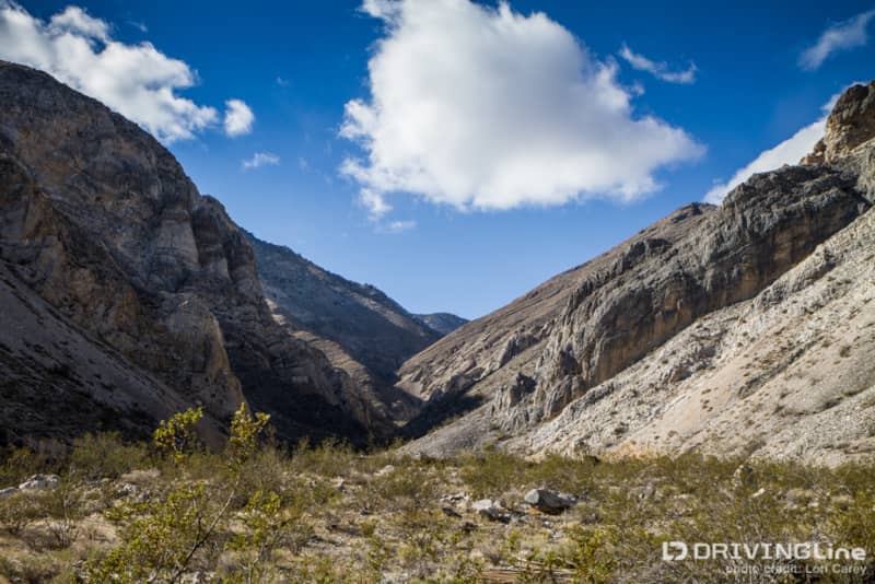
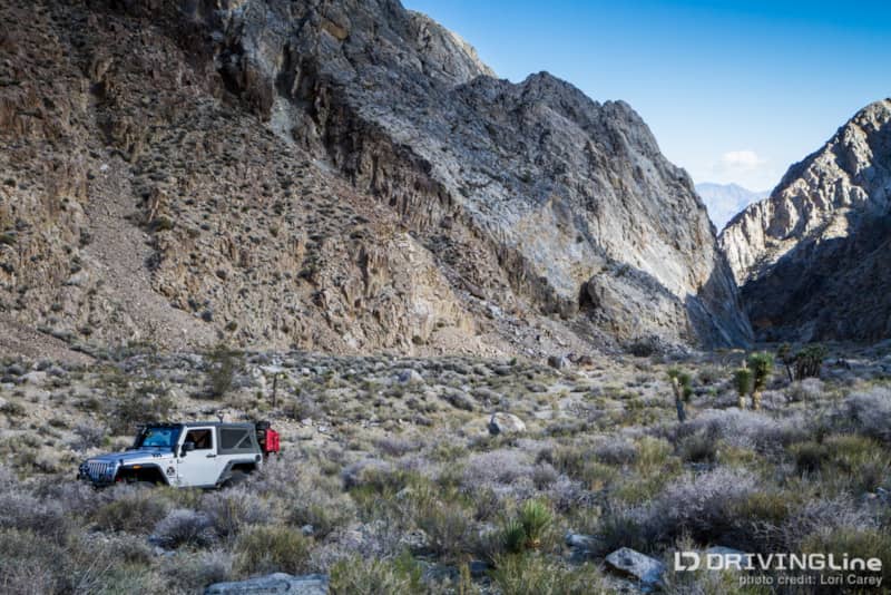
A glimpse of the trail ahead tells you this is no place to be during a flash flood. The canyon narrows and the walls of the mountains tower above you on either side. In some spots, the trail is actually in the riverbed as it continues a steep and rocky ascent; at other times, there is just enough room for the trail to follow alongside the riverbed.
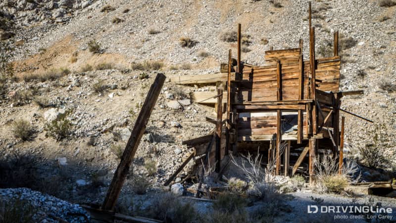
Halfway up, we found the remains of an old mine. There were some rusty parts lying nearby. On the other side of the trail, we found enough old wood to suggest there had been at least one structure here at one time.
The views ahead were dramatic and breath-taking. The trail continues winding its way through the narrow canyon as it ascends to 4,833 feet above the desert floor. Most of that ascent occurs in three miles, and while there are no drastically steep climbs to tackle on the trail, your vehicle will definitely get a work out with the steady climbing on a rocky trail.
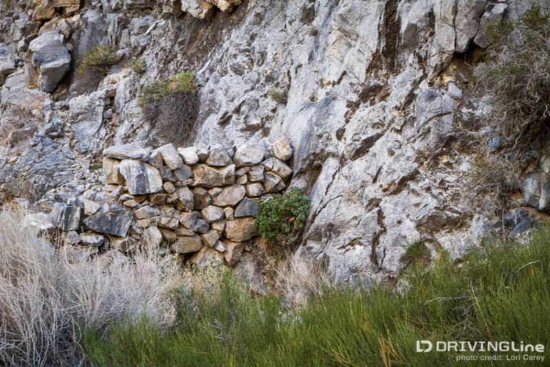
We spotted a spring on the canyon wall where someone had drilled a hole into the side of the mountain and built a rock wall to retain the water.
Deep in the mountains, the trail leaves BLM land (Point B on our map) and enters the Argus Range Wilderness Area. If you are using a GPS, the route will disappear from the map. The well-defined trail does continue beyond that point even though it doesn’t show on maps. Lying on the ground at the base of one of the Joshua Trees in a side canyon is a sign marking the boundary with the adjacent military base. I would be careful about hiking too far off the trail once you leave the BLM property because the boundaries aren’t obvious.
We found the perfect place to stop for lunch and stretch our legs.

Sandwiches and chips were on the menu as we admired the view.
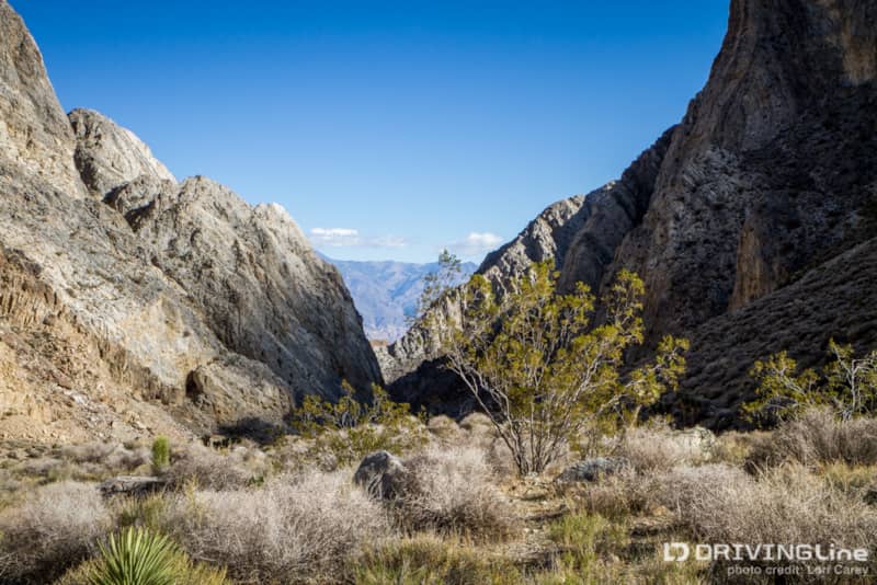
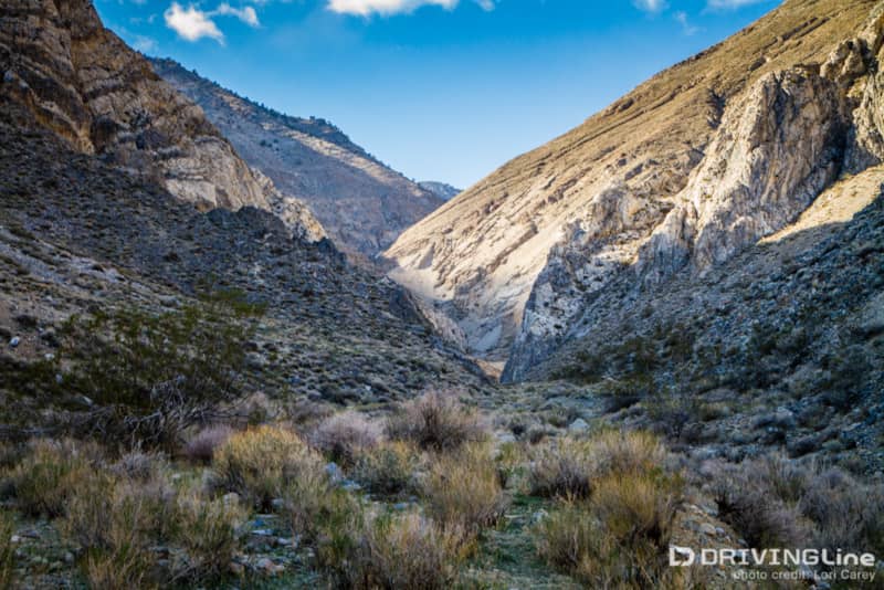
The view looking back down the canyon, across Panamint Valley to the Panamint Range was incredible. For the entire length of the trail we couldn’t decide if the view ahead of us or behind us was better.
We figured it was time to start heading back down if we wanted to reach camp before dark, but we were both surprised at how quickly we made it back to the valley. Going downhill is much faster than climbing up hill on a rough trail!
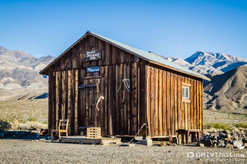
With some time to kill, we decided to visit the nearby ghost town of Ballarat. A quick drive down a 3.5 mile dirt road took us to what remained of the town at the base of the Panamint Mountains. Ballarat is often used as a base camp by off roaders exploring the trails in the mountains and Panamint Valley. A $2 donation is suggested if you camp here.
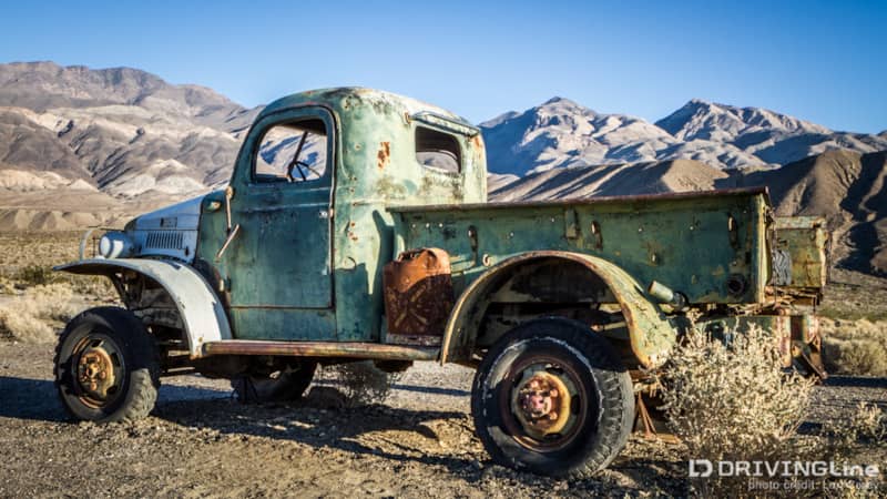
We stopped in to chat with Rocky, the caretaker and proprietor of the General Store. The store isn’t much, mainly cold drinks, a few maps, and a dusty museum, but the hospitality is genuine. We enjoyed some of Rocky’s homemade moonshine before going outside to drool over the 1942 Dodge Power Wagon, one of two that were owned by Charles Manson. The Manson Family’s Barker Ranch hideout was in the mountains above Ballarat, and the rough Goler Wash trail to the ranch required 4x4. Most of the ranch was destroyed in a fire in 2009, but many adventurous off-roaders still make the trek to the notorious location.