The Tortoise and the Jeep: Koehn Lake Trail Hunt
The Koehn Lake Trail is much shorter than trail guides would have you believe. This is partly thanks to the actions of irresponsible off-roaders and environmentalists.
It started out as a tortoise hunt. My husband had been lamenting that in all the years we’ve been exploring the Mojave Desert, we still haven’t seen an endangered desert tortoise in the wild. I teased him it was because he usually doesn’t join me on my hikes, but he was right – it was disappointing that we still hadn’t seen even one.
When I was consulting my trail guides to plan our next adventure, I discovered that the Koehn Lake Trail rides along the boundary of the Desert Tortoise Natural Area and then through another prime desert tortoise habitat in the Rand Mountain Fremont Valley Management Area. I put the trail first on our route and was determined to find a tortoise.
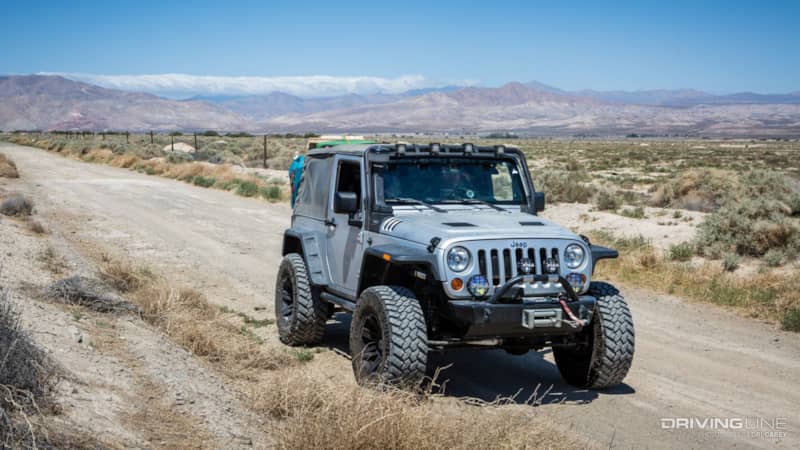
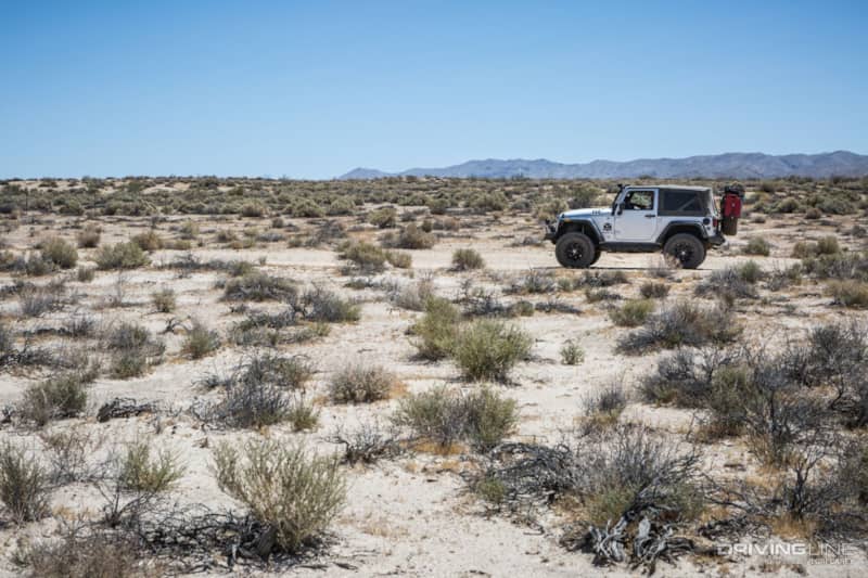
Koehn Lake Trail starts in Rancho Seco, a tiny town north of California City and close to Jawbone Station in Kern County. The paved Munsey Road turns to dirt after four miles. I was a little disappointed to find a graded road, but I knew that we would soon be heading up into the Rand Mountains on a more challenging trail.
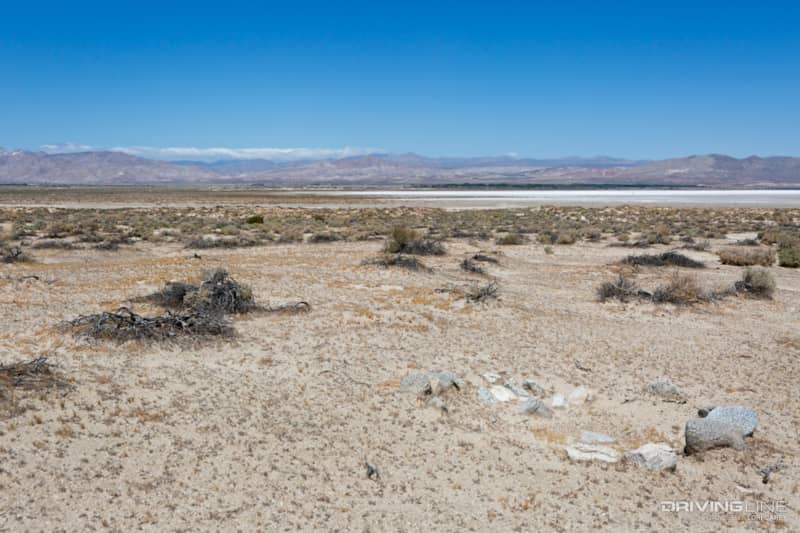
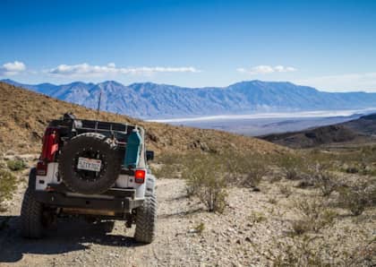
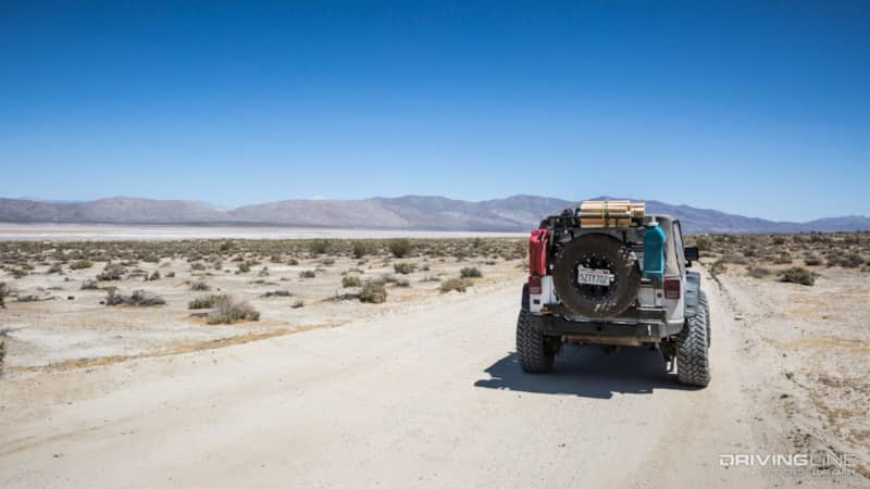
The road travels between the boundary of the Desert Tortoise Natural Area on one side and the edge of Koehn Lake on the other. We could see the brilliant white salt flats off in the distance. Koehn Lake is a geologic anomaly; it is a moist dry lake bed, and the capillary action of ground water rising to the surface carries salt, which is deposited on the lake bed. The remains of the Saltdale mining operations can be found on the opposite side of the lakebed.
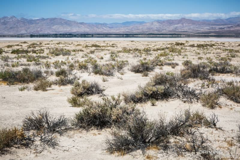
The beautiful mountains in the background stand in stark opposite to the harsh environment of the lake bed.
There are a few turn offs that will take you closer to the lakebed, but you can cannot drive on the lakebed.
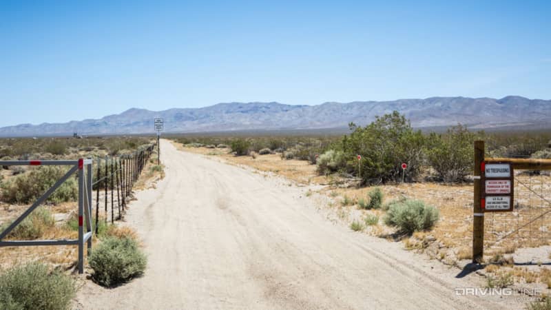
There is a wire fence along the entire boundary of the Desert Tortoise Natural Area. You have to look hard to see it in the photos, but trust me, the fence is there along the entire length. Although hiking is permitted in the Natural Area, the only entrance is seven miles away as the crow flies and 23 miles away by road. Still, we drove slowly and carefully, futilely hoping to spot a tortoise beyond the fence. I was a bit disappointed, but I knew that once we had passed the Natural Area and began ascending into the Rand Mountains, we were still in their habitat and had a fair chance of spotting one while hiking.
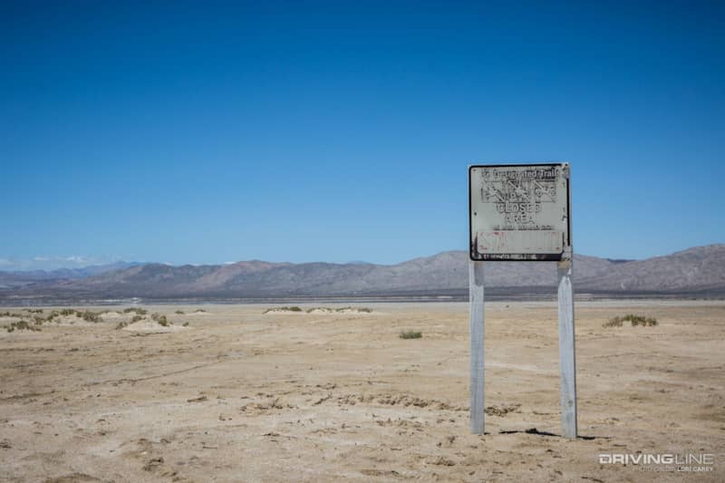
Koehn Lake Trail Closure
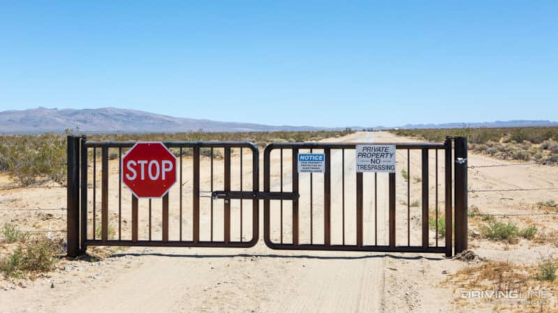
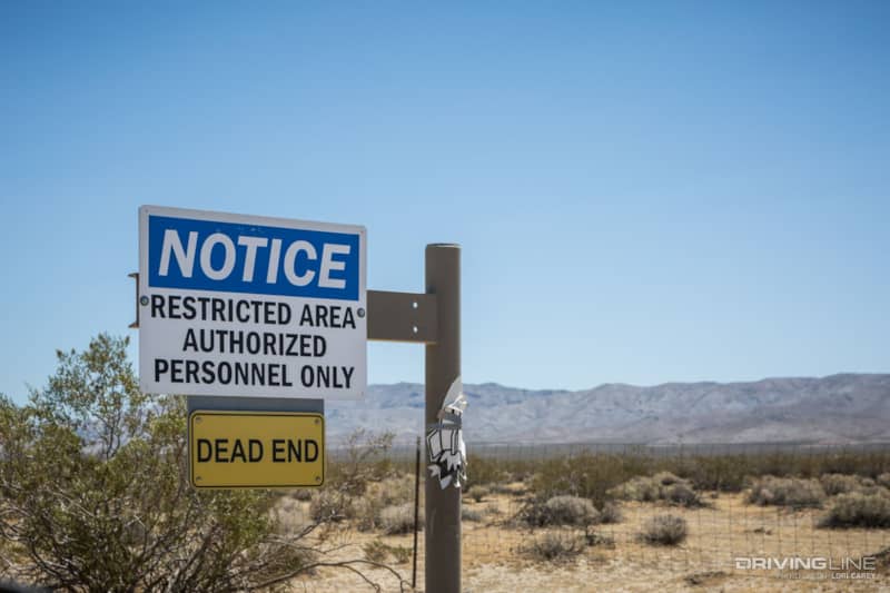
My optimism vanished in a flash when we reached the turnoff for R5. There is a gate blocking the trail. Straight ahead are more warning signs. Everything was marked No Trespassing, Private Property and there’s nowhere to go, except to turn around. Confused, I check a different map and see that the area is marked as a Special Management Area, but it’s only noted that riders must stay on signed trails. That’s not the same as Private Property!
If you’ve been reading my off-road trail articles, you know that it is not uncommon for me to reach a dead end on what should be a continuing trail. Massey and Wilson’s Backcountry Adventures, with directions and descriptions for 153 off-road trails, used to be the bible for Southern California off-road explorers. Over the past 2-3 years, I’ve found that an unfairly large percentage of the trails we’ve attempted (including several that I had previously traveled) have closed, been redirected, or if they are still open, they have been renumbered. Sadly, the book is no longer a reliable resource and you need to be prepared to either turn around or plan an alternate route on the fly.
Even if a trail is open, you need to be able to navigate without the help of the correct trail numbers. My husband and I are comfortable with route finding and we’re prepared for the challenges, but what about people who aren’t? As I scribbled notes in my book, consulted my maps, and searched for alternate routes, I thought of all the times I’ve had to do this recently and contemplated how much work it would be to write a new book for southern California. Every time I visit somewhere special in the backcountry, I know it might be the last time.
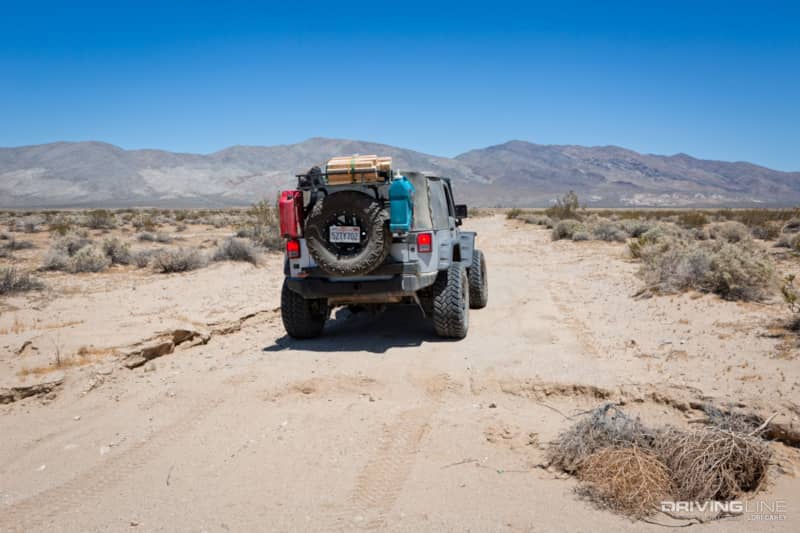
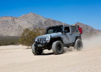
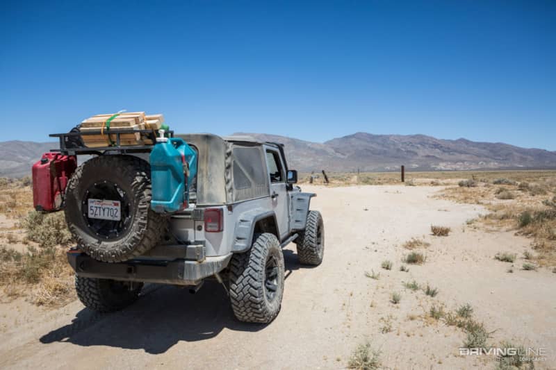
There was no alternative route or missed turn. I cursed as I acknowledged that we had no choice but to turn around and retrace our steps. This day the Trail Grapplers would get a solid desert workout.
On our way back, we turned onto a wide sandy trail that we thought was one of the offshoots leading down the lakebed and decided to take a closer look. Instead of taking us closer to the lake, it began to angle away.
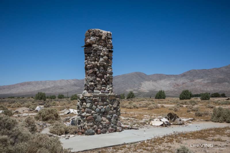
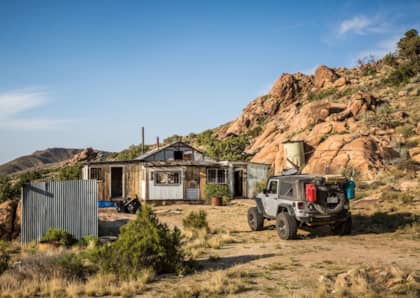
A little further down the trail were the extensive remains of an old ranch or homestead.
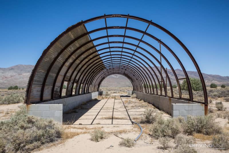
There was also a large water holding tank and the skeleton of a Quonset hut.
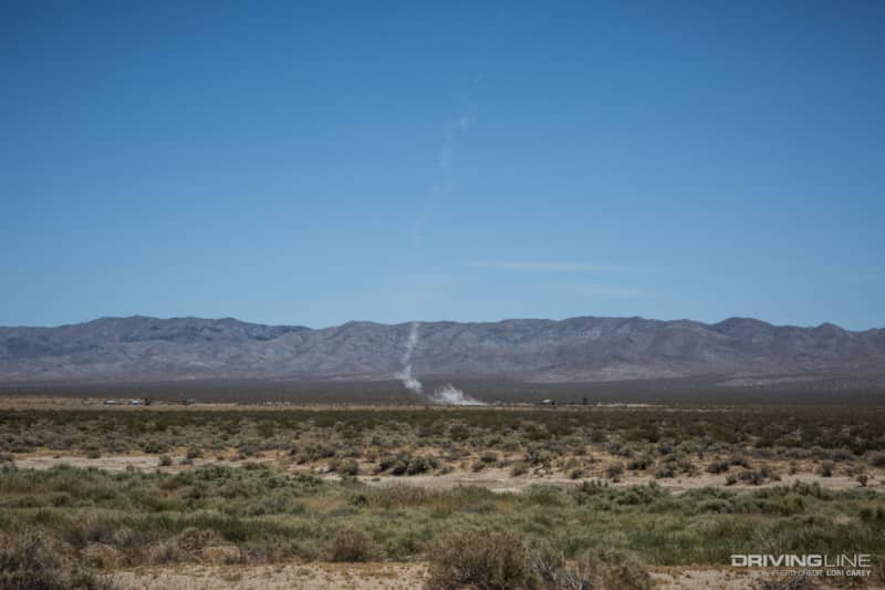
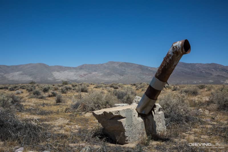
While we were poking around, I glimpsed a rocket take off in the distance. My husband didn’t believe it was a rocket. We joked about all of the super-secret military testing that goes on in the Mojave, and maybe that’s why everything in the area is closed off now. Whooosh! Another rocket fired off, and this time we could tell that it was a good size. I later learned that both the Mojave Test Area (MTA) and the Friends of Amateur Rocketry (FAR) are located next to each other here, right on the border of the Desert Tortoise Natural Area. These groups are not firing off your average backyard rockets.
We had hoped that the side trail would continue straight through to Redrock-Randsburg Road and bring us closer to our next destination, but once again, we ran into a fence and Private Property signs. The entire area surrounding Koehn Lake is now private property or closed BLM land. The only thing you can do is drive up and down a graded road and hike out to the dry lakebed. You can cross this trail out of your books, folks.
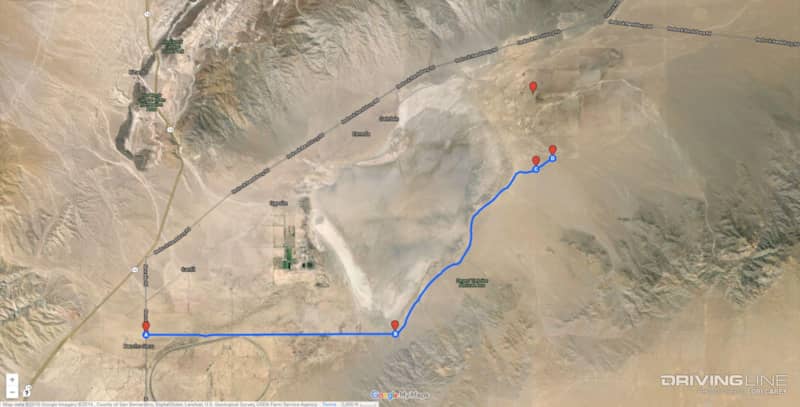
The other marker on the map is where we found the old homestead. I’m not showing that trail because I believe it may not have been a designated open trail despite not being marked with a red post.
Trail Update
After weeks of researching, I found that 29 miles of open BLM routes in the western Rand Mountains were closed in 2002 to protect the desert tortoise. Two of those trails, including R5, reopened in 2008 with an education and permit process in place. The Center for Biological Diversity, which had sued for the initial 2002 closure, appealed the decision to re-open the trails. In 2010 the judge ruled in favor of the Center for Biological Diversity and the BLM was ordered to again close the trails. Apparently they have been closed under the Temporary Interim Closure ever since. The brochure I have for the area was obviously printed during the two years the trail was temporarily re-opened. The only currently open route in the western Rand Mountains is R43.