Last Chance Canyon Trail, Red Rock Canyon State Park
In my article about exploring the El Paso Mountains, I mentioned that the rock crawlers would want to head to Last Chance Canyon. This beautiful and remote canyon provides enough of a challenge for heavily modified vehicles, while still being possible with a stock high-clearance four-wheel-drive rig in the hands of a capable driver with a good spotter.

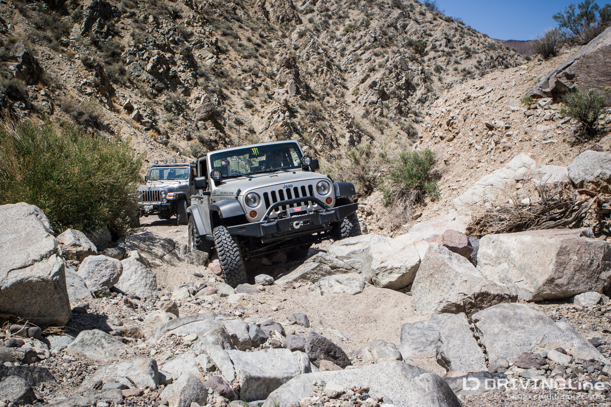
The trail starts in a wide, sandy wash off Randsburg-Red Rock Road, six miles northeast of Highway 14, in Red Rock Canyon State Park in Cantil, California. It is marked as EP80 with an OHV sign. The trail climbs up the bajada before entering Last Chance Canyon. There is a formed trail that bypasses most of the obstacles by following alongside the wash, but the more capable vehicles and drivers will want to stay on the trail in the wash. The very first obstacle is a small ledge climb that serves as a gate keeper. There is a very large network of trails throughout the El Paso Mountains and this is one of the most technical (Nightmare Gulch is the other, but it is no longer open). A gate keeper is a good way to make sure no one mistakenly heads down a trail that they are not prepared for. I didn’t get any photos of this ledge because I was too busy behind the wheel!

The sand in the wash is deep and loose and requires your best sand driving skills. Street tires are not appropriate for this trail unless you don’t mind having to be strapped every time you get stuck (and your buddies don’t mind getting you out every time you get stuck).


As the trail winds its way through the canyon there are a couple more ledge climbs that will test your skills.
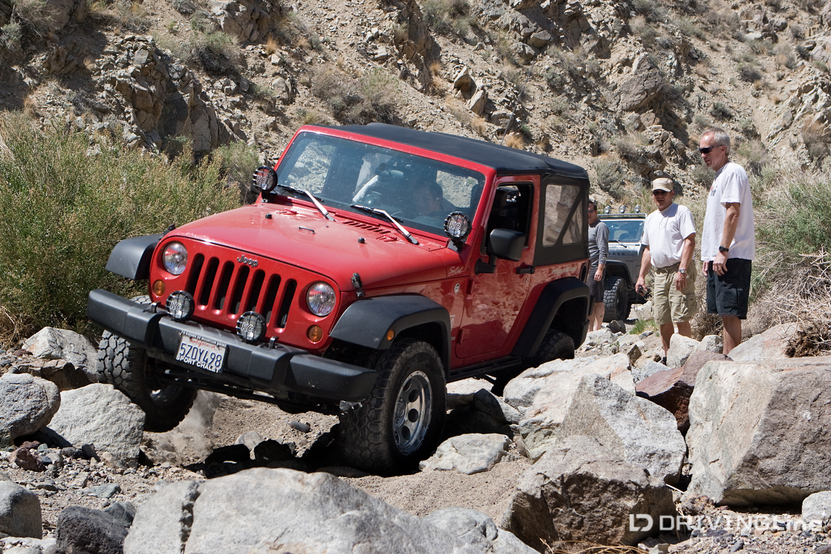
The rocky sections require careful wheel placement and a good spotter always helps.

High clearance is a must. Even then you risk getting hung up and damaging your undercarriage if you aren’t careful.

The easier formed trail alongside the wash is still a fun challenge for stock vehicles or less-skilled drivers.

The scenery out here is gorgeous. We found a beautiful spot with multi-colored hills on a side trail where we stopped for lunch while waiting for the rest of the group to catch up.

You’ll pass the remains of Cudahy Camp but all that is left are some concrete and stone foundations. We also found some open mineshafts (be careful where you walk) with some veins of green rock. I’m not sure what it is, I need to brush up on my rock hounding skills. Agate, jasper and petrified wood are common in this area, but collecting is prohibited within the park.

We found an overlook on a side trail with a beautiful view. The elevation here is 3,800 ft. To put it in perspective, look for the truck on the trail in the lower right of the photo.


Across from Cudahy Camp is EP88 Opal Canyon Road, which heads west toward Nightmare Gulch and eventually turns out on California 14. EP80 Last Chance Canyon continues north and the final obstacle is a very steep low-traction climb out of the wash. There is no bypassing this obstacle; there is a choice of a rocky, rutted off-camber climb up the dirt trail (which no one in my group took) or up steep slick rock with a bump halfway up that often results with a tire in the air. This final obstacle is where the trail earns its difficulty rating of 5, while the rest of the trail is rated 4. Once again, good off road tires are a must for the traction required to get out of the canyon.
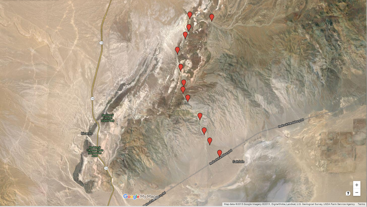
Once out of the canyon, the trail opens up and becomes much easier. The trail continues on BLM property and it’s important to note the park boundary line because the rules are different. For example, there is no dispersed back-country camping permitted within the park, but it is allowed on the BLM side of the trail. When you reach Bickel Camp, you have the option to take some of the trails I described in my previous El Paso Mountains article. There are several interesting historical and archaeological sights to see in this area, as well as mines and mining camps to explore. If exploring the sights on easy trails doesn’t interest you, continue on Last Chance Canyon Road/EP15 until it reaches California Highway 14. Click here for a link to the park trail map that shows the boundary line. The Park visitor center is closed during the summer and winter and there is no phone to the park. For information you can call the California Parks Mojave Sector Office at 661-946-6092. The nearest facilities (gas, phone) are at Jawbone Station on California Highway 14 in Mojave, so keep an eye on your gas tank.


I’ve had a few people ask me about Nightmare Gulch because these two trails had often been done together. Nightmare Gulch is subject to seasonal closure during the raptor breeding season, and when the trail was open from July 2 to January 31 every year, motorized traffic was only permitted from the 15th through the end of the month. Many of us planned our trips to Last Chance Canyon around times when Nightmare Gulch would be open. However, in October 2013 the trail was shut down without warning and the notice said the closure was permanent. The park claimed it was due to storm damage (which many disputed), but there were a few articles posted online which claimed that a large group of off-roaders had driven around the gate during a seasonal closure and had caused damage off the trail. After getting some pressure from the off-road community, the park said that the permanent closure notice was a mistake and they changed it to a temporary closure. That temporary closure has now lasted two years, and at this time, Nightmare Gulch remains closed. Anyone who has done the Nightmare Gulch trail can tell you what a challenging and beautiful trail it is (was). So, please respect trail closures and obey the rules so you don’t risk permanently jeopardizing access for all of us.