Geology Touring in Joshua Tree National Park
Joshua Tree National Park’s Geology Tour Road is a self-guided 4x4 tour through some of the best scenery this park has to offer. Ordinarily, we wouldn’t be running desert trails in the middle of summer. It’s too hot, there’s a strong possibility of flash floods, it’s too dangerous, and every year people die when their vehicle breaks down and they aren’t found for days…sometimes longer.
But, we do like to head out to the desert in the evenings to photograph the Milky Way, and we had been talking about trails in the Joshua Tree National Park for a bit, so we figured it would be easy enough to head out a few hours early and run a trail before we settled down for some night shooting. We have to preface this article with a strong “don’t try this at home” unless you are very experienced, well prepared, and willing to accept the risks. Go in the fall, winter, or spring – you’ll enjoy it more.

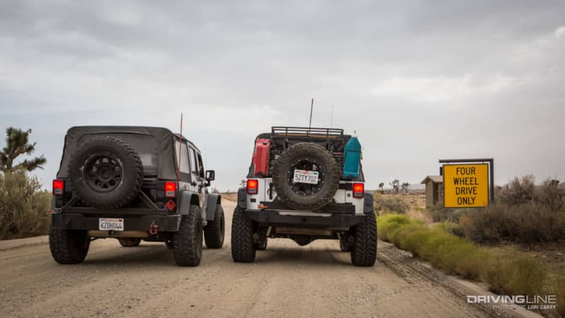
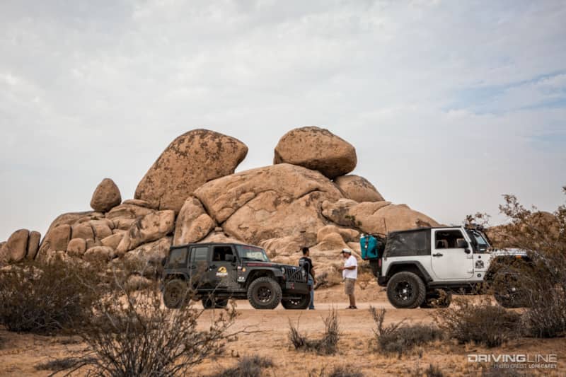
Our friends Nicole and Miguel decided to brave the heat and join us for the trail. They are experienced off-roaders who love the outdoors. It was good peace of mind to have another vehicle travel with us. Nicole’s Wrangler is done up as Jurassic Park Ranger Jeep because her young son loves dinosaurs.
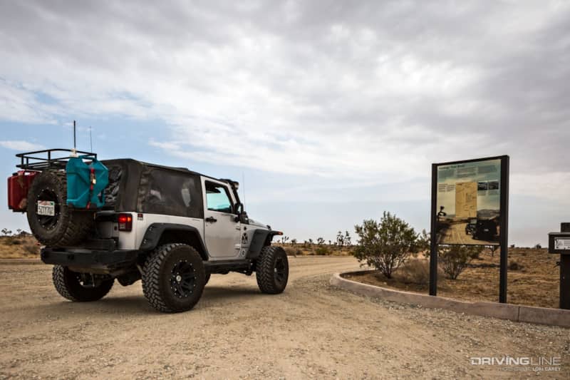
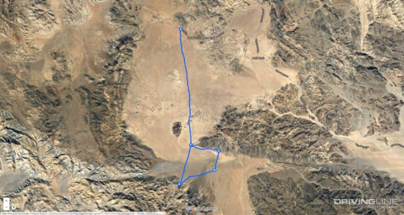
Joshua Tree National Park has a limited number of backcountry trails. Most of them are merely dirt roads that are accessible to everyone, but there are a few which require high clearance and four-wheel drive. Geology Tour Road is an 18-mile loop trail on the western side of the park. The trail is so named because it is a self-guided tour with 16 points of geological interest along the way. Make sure to pick up a brochure in the box at the trail head for information about each of the stops.
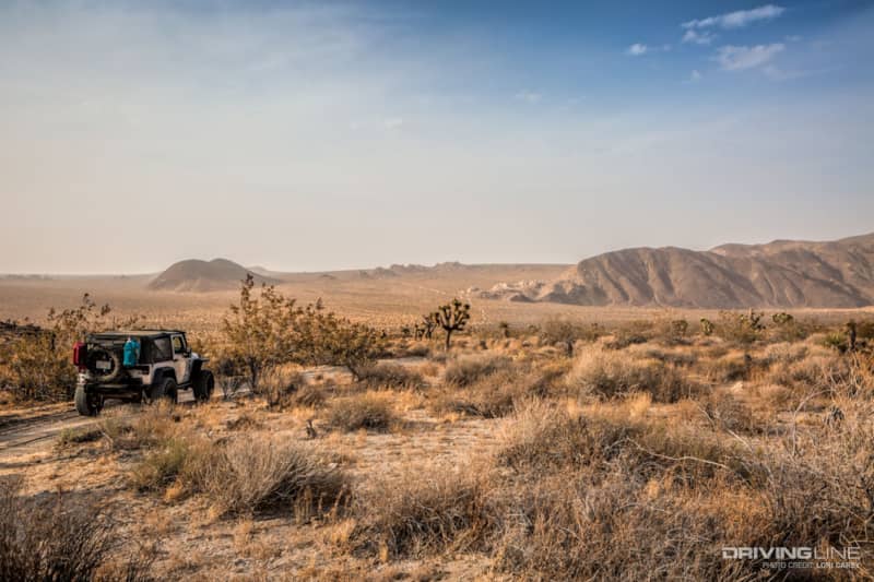
As luck would have it, there was a monsoon blowing into neighboring Arizona, but it wasn’t forecast to hit the Joshua Tree area until Monday. That was good and bad. The cloud cover brought the temperature down 20 degrees lower than it had been earlier in the week, but the strong storm was already blowing a massive amount of dust into Southern California. It was as if a thick layer of smog and fog had descended on the desert, and visibility was very limited.
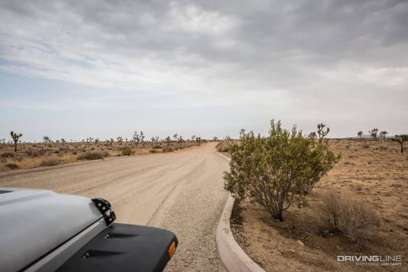
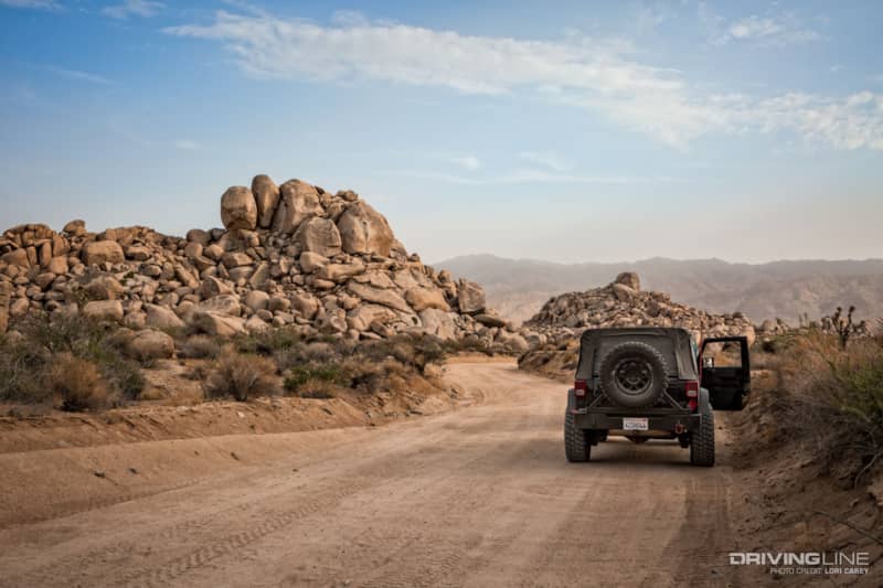
The trail begins off Park Blvd. directly across from Desert Queen Mine Road, two miles west of Jumbo Rocks Campground. The trail starts off as a well-graded sandy road. RV and passenger cars can travel the first 5.4 miles to stop #9 at Squaw’s Tank. Beyond Squaw’s Tank a high-clearance 4x4 vehicle is recommended.
The 16 stops along the tour are not easy to spot.
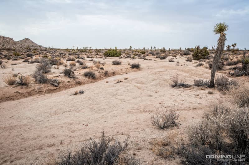
You need to look for brown posts with barely visible sun-faded numbers that match the numbered descriptions in the brochure. When you find one, stop and get out. Don’t make the mistake that we did the first time. The geological features described in the brochure are not usually visible from the trail. You’ll need to look for a small unmarked footpath and follow it until you find the feature described in the brochure. There is no other signage that will let you know when you’ve arrived. If you’re not familiar with desert geology, you may find the hunt a bit frustrating at times.
Stop #3:
Above is a photo taken at Stop #3 – Nature’s Gutter. It is an example of a desert wash, and the brochure warns of the hazard of flash floods. We’ve spent a lot of time in desert washes and this isn’t the best example of one, but it was the closest thing to a wash with evidence of regular water movement that we could find in this area. We found some older photos of the wash and realized that weather and erosion had caused drastic changes over the years.
Stop #10:
Some of the numbered posts appear to be missing, and the descriptions of some of the stops have changed over the years. Stop #10 used to mark petroglyphs, now the brochure only describes Pleasant Valley and the Blue Cut Fault. If things don’t seem to be making sense, don’t get too frustrated, just enjoy being outside in a beautiful place, do some exploring and have fun.
Stop #4:
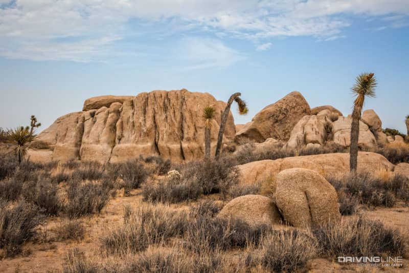
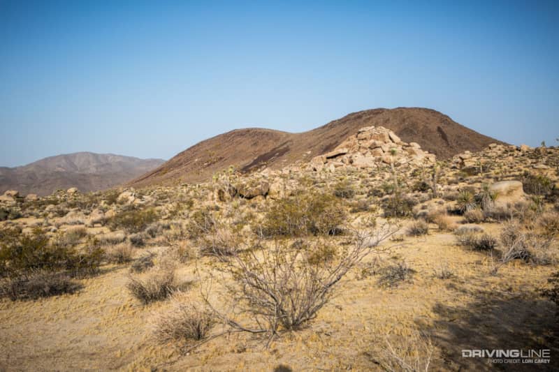
Joshua Tree is perhaps best known for its dramatic rock formations, and there are some spectacular examples along the trail. This is stop #4 – Old Erosional Level. The brochure describes how erosion affects the shapes of the rocks.
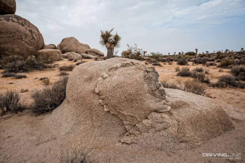
If you appreciate geology, you will enjoy all of the information in the brochure about monzogranite, Pinto Gneiss, dikes and joints and inselbergs. If you aren’t into geology, it’s still a lot of fun to check out some of the stranger formations and learn how they were formed.
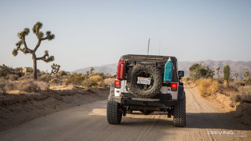
The trail gradually descends into Pleasant Valley and there are some fantastic views along the way. Pleasant Valley is bordered by the Hexie Mountains to the East and the Little San Bernardino Mountains to the West.
Stop #7:
Stop #7 – Malapai Hill is made of black basalt, most likely as a result of molten magma that never quite reached the surface of the earth. An older brochure states that if the magma had reached the surface, a volcano would have formed. The latest version clarifies that if it ever did reach the surface, it has since eroded.
Stop #9:
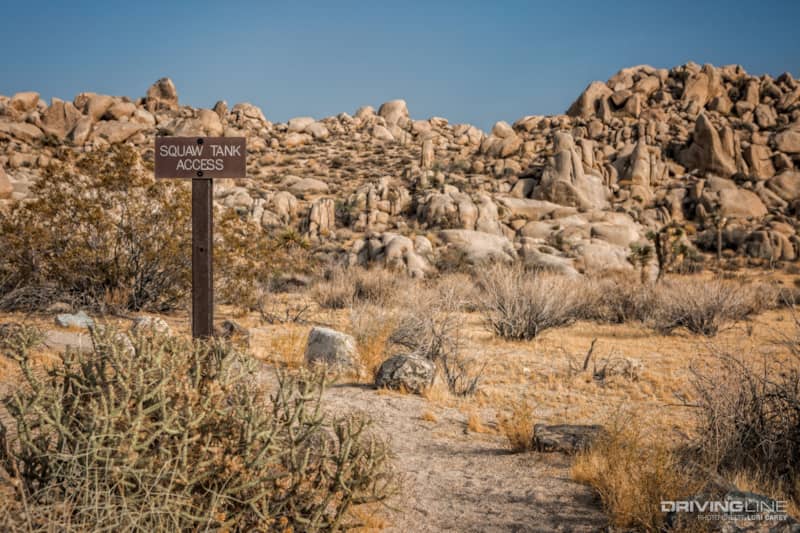
Stop #9 at Squaw Tank is the only stop that has a sign pointing the way to the path. If you only make one stop along the trail, make it this one because there is much to explore here. In addition to the manmade concrete dam at Squaw Tank that was built to collect runoff water for cattle, there are some fascinating rock formations and several bedrock mortars, or morteros, in the surrounding area.
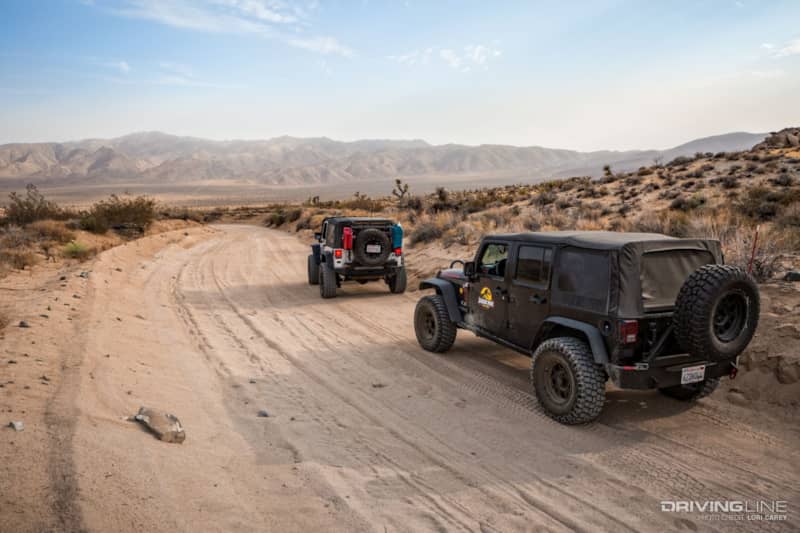
Down in Pleasant Valley the trail becomes deep sand. There are some rougher spots, but nothing technical. It’s very suitable for a beginner in a stock SUV that has high clearance as long as you know how to drive in sand. Don’t be put off by the warning signs. A good set of off-road tires is also a plus. Airing down our 35-inch Nitto Trail Grapplers helped smooth out the bumps and make for an even better ride.
Joshua Tree National Park lies in the transition zone between the Colorado Desert and the Mojave Desert. The eastern half of the park lies within the Colorado Desert, below 3,000 feet. The western half where Geology Tour Road is located lies within the Mojave Desert, at elevations above 3,000 feet. The wild-looking Joshua Tree for which the park is named only grows in the Mojave Desert. The Joshua Tree isn’t really a tree; it is a type of yucca.
The trail makes a large loop through Pleasant Valley before reconnecting with the two-way portion of the trail for the return to Park Blvd. Even if you have absolutely no interest at all in the Geology Tour, this trail has some spectacular views and is a great way to get away from the park crowds.
Know Before You Go:
- Dispersed backcountry camping is only permitted one mile or further from the road, and open fires are not permitted.
- There are several campgrounds in the park, but reservations aren’t accepted and they can be crowded on weekends.
- There is overflow camping on BLM land to the north and the south of the park.
- The park entrance fee is $20 per vehicle.
- Make sure to top off your gas tank before entering the park; distances are great and there are no services inside the park.
- There is no cell phone service on the trail, so make sure to bring all of your desert survival gear, especially plenty of water.