Traveling the Extended Nadeau Trail via Slate Range Crossing
A while back we told you about our adventures exploring the Nadeau Trail, which had recently been designated a National Recreation Trail. Nadeau was a teamster who hauled silver-lead bullion and supplies between Cerro Gordon and Los Angeles with 20 Mule Team wagons. Since it was difficult to make a turn with a long 20 Mule Team wagon, when Nadeau built the road, he built it straight as an arrow through Panamint Valley. It soon became known as Remi Nadeau’s Shotgun Road.
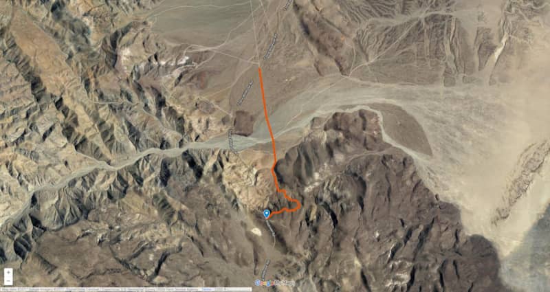
We later learned the original road was 230 miles long, stretching all the way from Cerro Gordo to San Pedro. Most of the original road is long gone, just 28-miles of it were incorporated into the National Recreational Trail. After a friend told us that the unmarked trail opposite the official trail head signage is a continuation of the original road, we knew we needed to go check it out. So this Slate Range Crossing journey begins...
Getting Started on the Slate Range Crossing
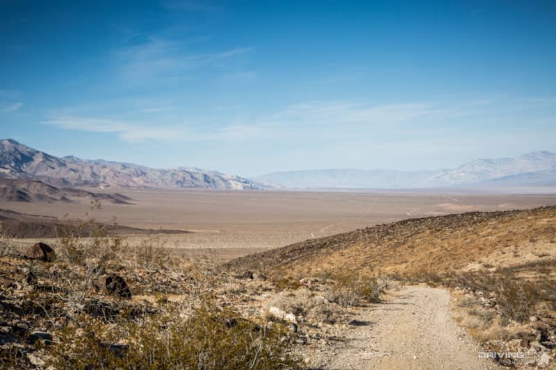
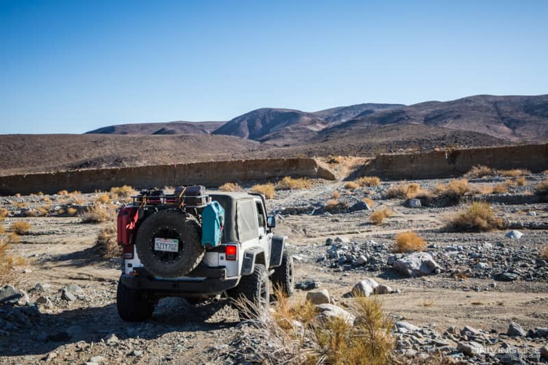
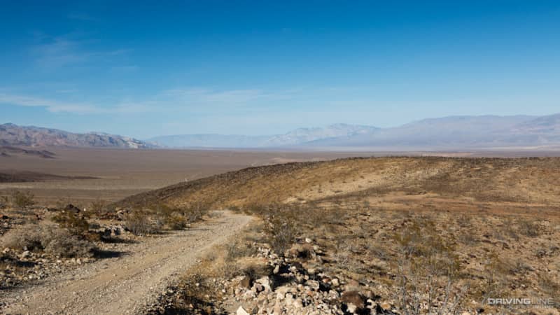
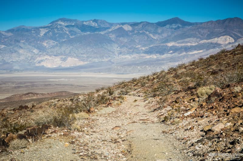
The unmarked trail begins in a bland, boring section of Panamint Valley in just an ordinary, flat desert road. The scenery was nothing to look at. After a few miles we began to wonder why our friend sent us here, or if we had perhaps misunderstood his directions. As we neared the Slate Range though, things got a little more interesting. The trail took us into a huge wash with a steep climb out on the other side.
The trail began to climb the hills toward the mountains. This section of the trail is also known as Slate Range Crossing, not to be confused with the Slate Range Trail which climbs to a higher elevation and takes a much rougher route a few miles away.
Finding Scenic Views in Panamint Valley
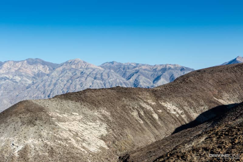
The trail has panoramic views of Panamint Valley, the Argus Range and the Panamint Mountains.

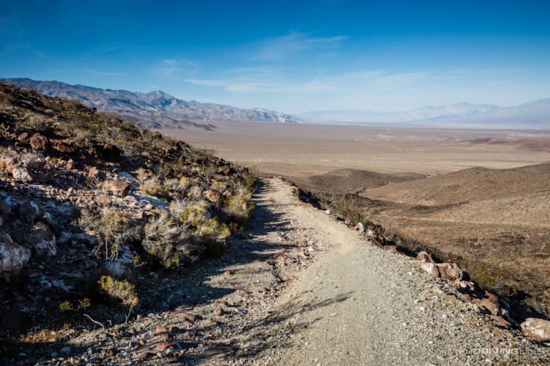
As we climbed higher, the trail became a steep and narrow shelf road; so narrow that in some spots there wasn’t even room to get out of the Jeep to take a photo. We realized that if anyone was coming down the trail, it wasn’t going to be very fun for either one of us to try to drive backward. If you aren’t comfortable on extremely narrow and extremely steep shelf roads, this is not the trail for you. I was glad to be riding shotgun so I didn’t have to look over the edge.
Learn how to navigate technical terrain in our off-road basics article.
Slate Range Crossing Trail History
It was here that we noticed the most interesting thing about this trail, and the most likely reason for leaving it out of the official National Recreational Trail designation. Much of the shelf trail is stabilized by extensive rockwork. Chinese laborers built many of the desert roads during the mining heyday, and they were masters at working with rock. If you’ve visited the Charcoal Kilns in Death Valley, you know that they were also built by Chinese laborers. There isn’t more than a brief mention of their work in the history of the area, but the National Park mentions that they were paid $1.25 per day for their back-breaking work.
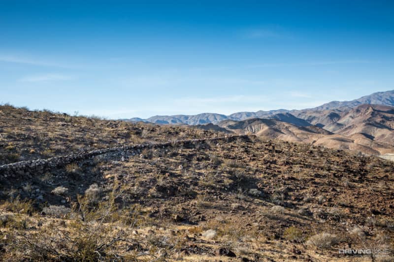
There are similar examples of this type of road stabilization along the Nadeau Trail, but this is the most extensive stretch, and it’s amazing to see what great shape it is in after more than 130 years. It’s completely safe, but we think it was probably left out of the National Recreational Trail designation to reduce the number of people driving this section.
Each turn in the trail brought us a new view of the mountains and valleys surrounding the trail in all directions.
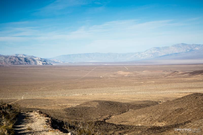
Down below it was easy to see how Shotgun Road got its name as it shoots straight across the valley toward Panamint Springs. The curved road to the right of the trail is the paved Trona-Wildrose Road heading toward Ballarat ghost town.
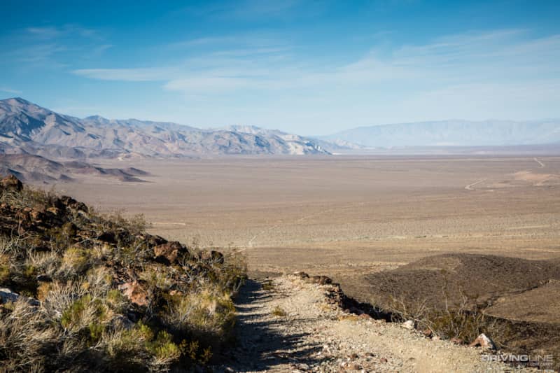
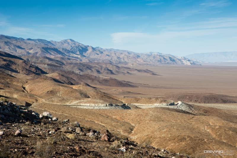
As we neared the top we could see where Trona-Wildrose Road cuts through the mountains. Anyone who has driven the road will recognize this stretch of dangerous curves. If you have a fascination for the morbid, from the trail you can often spot vehicles that have gone over the edge. We didn't spot any, but maybe because we were too busy checking out the view.
Off-Road Difficulty Trail Rating for Slate Range Crossing
The trail is rocky and rough, but there are no technical obstacles and no off-camber sections. Going uphill we did use 4WD in the steepest sections. The views would be even more spectacular going downhill, but be sure to use a low gear. Even though this is an easy trail that can be done in an SUV, I would not recommend doing it with street tires; you are going to want a tire with good off road traction like the Nitto Trail Grappler.
If you’ve driven to Panamint Valley or Death Valley via Trona-Wildrose Road, you’ll recognize this spot where there is a small turnout for the scenic view. The Slate Range Crossing trail terminates right at the turnout. If you’ve ever pulled into that spot to take some photos and wondered where the trail goes, now you know. As you exit, turning left will take you to Trona, and turning right will lead you to Ballarat ghost town.

We noticed that the trail seems to continue on the other side of Trona-Wildrose. It was too late in the day to risk exploring an unknown trail, so that’s an adventure saved for another day!