Navigational Basics: Tips for Learning Traditional Navigation
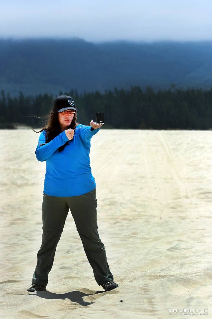
Navigation is critical, whether via map and compass, GPS or even directions from your spouse. If you don’t know where you’re headed, you may be bound for a long ride home or even worse—disaster. If you’re interested in learning traditional navigation (using map and compass) there are several important things to learn before you go. This article is the first of a two-part series teaching you about traditional map and compass navigation.
Latitude
Basic navigation includes two important terms: latitude and longitude. Understanding these terms is imperative when using topographic maps with a compass. Latitude is the angular distance of a place north or south of the earth's equator. It’s usually expressed in degrees and minutes. Latitude is indicated on maps using lines drawn from side to side. They’re imaginary parallels running east/west around the globe (i.e. they parallel the line of the equator).
Longitude
Longitude is the angular distance of a place east or west of the meridian at Greenwich, England. The Greenwich meridian is an imaginary line used to indicate 0° longitude and terminates at the North and South Poles. All other longitude meridians are numbered both east and west of this. Longitude is also usually expressed in degrees and minutes. In less technical terms, longitude is known as lines drawn on a map that run up or down, or north/south, around the globe. They’re imaginary lines that run vertically on a globe, with varying curvature.
Why degrees and minutes, you ask? A circle is broken up into 360 degrees, each one a fraction of a circle or a sphere. Just like apple slices are thinner at the ends, a single degree equals a different distance at the poles (or ends) than at the equator (the middle). That’s why we use degrees and minutes. Minutes further divide the degrees up into thinner slices so that we can have more usable distances where the degrees are too far apart.
Declination
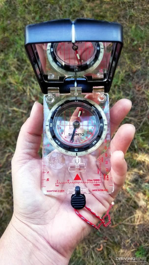
Declination is the difference between true north (the direction along Earth's surface towards the geographic North Pole) and magnetic north (the direction the compass needle points). Magnetic declination is the angle between magnetic north and true north. True north sits at the top of the globe. Magnetic north, which is where your compass needle points, is a result of the Earth’s magnetic fields and its core elements, and is not aligned with the top of the globe. Understanding the difference between true north and magnetic north is key, since following your compass north will not take you to the North Pole. Knowing how to set your compass correctly is known as declinating your compass.
If you plan on navigating more precisely than a general heading of north, south, east and west, you should invest in a compass with an adjustable declination. It’s not an expensive feature. It will make navigation simpler and make you less prone to mental mistakes. Investing in a good compass can be a lifesaver.
Important Tips
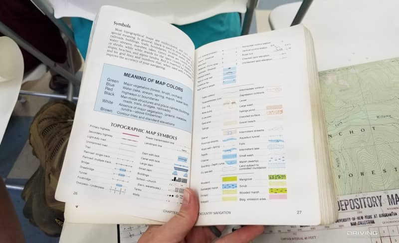
Make sure you’re familiar with topographic map symbols. Know the differences between railroad tracks, rivers, power lines and contour lines. Understand what a mountain peak vs. a depression or crater looks like. Bring along thinly leaded mechanical pencils and erasers too. Knowing topo (topographic) map symbols could be the difference between success and failure during your travels.
Be sure to check the age of your map. If you purchased a map from 1988 and you plan to use it in 2018, elements may be missing or wrong. After all, it’s 30 years old. Buildings, cell phone towers or other structures may not always show correctly on maps. Purchase the latest map set you can find.
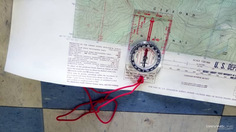
Understand the different scales of topo maps, and make sure you use a pen and a piece of string when measuring them. If you have a 1:50,000 map, for instance, one centimeter on the map equals 50,000 centimeters (or 500 meters) in the world. Measuring with a pen and string, or even using your finger, could work depending how accurate you need to be. For instance, you can measure items like how far it is to the next town from an intersection and how far it is the next right-hand turn. String or your fingers can be good enough tools to use for survival and finding significant geographic features. If you wanted to get fancy, you could make your own ruler by ticking hash marks on it for every set of measurements the map indicates via its printed scale. For exact measurements, you can purchase coordinating map scales to match the exact scale of your topo maps.
If you plan on measuring your map correctly, you’ll need to either buy a 50,000 scale ruler, use a string or make your own using a piece of blank paper and ticking hash marks on it for every set of measurements the map indicates via its printed scale. The second isn’t as glamorous as a purchased ruler, but it gets the job done.
Taking the Right Steps
Know how many steps you take to get to 10, 25 or 50 feet, too. Grab a tape measure and a buddy. Have them lay the tape on the ground and count how many steps you take to get said amount of feet. Do this exercise a few times while pacing normally, as well as while taking longer strides. Then take the average amount of each set. This helps you measure your gate and track how far you’ve gone on the map. Typically, I take one step every two feet and stride every three feet. If your maps are in kilometers, you’ll need to convert your steps and strides from feet to meters. You take your measurement (in feet) and divide it by 3.28 to convert to meters. It’s a good idea to know the number of steps and strides you take, in both feet and in meters.
Tons to Learn
If this article overwhelms you, you’re not alone. Traditional navigation, even at the basic level, can be complex and hard to understand. Fortunately, there are people happy to teach you and so many ways to learn, from classes hosted by local organizations, to navigational hikes/demonstrations, online classes and even YouTube videos. In the second article of this two-part series, I’ll take a deeper dive into how you use a compass and map together to navigate traditionally.