The Dove Spring Pass Trail
We like to think that if a trail is included in an off road trail guidebook, it is worthy of taking. The reality is, management of open lands here in California is ever-changing and it seems that the Travel Management Plans (the official decision of what trails stay open, which ones are closed, and how the trails will be maintained (and by whom)), are always evolving. You never really know what you are going to find until you get on the trail, especially if the report you rely on is more than a couple years old.
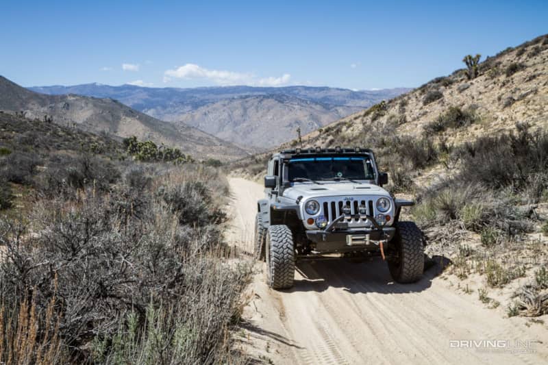
After exploring Bird Spring Pass, we were in the middle of nowhere on the opposite side of a mountain from where we wanted to be the next day. We looked for possible routes that would get us back over the mountain and heading in the right direction while avoiding any pavement, and identified three possibilities. Frog Creek was the first alternative, but a section of it appeared to be marked most difficult on our map, which eliminated it as a realistic option for solo travel. SC102 was marked with three gates and we didn’t want to take a chance on the gates at the top being locked. The last option was Dove Spring Canyon Trail, which was in our guidebook and described as an 18-mile long picturesque trail that requires high clearance.
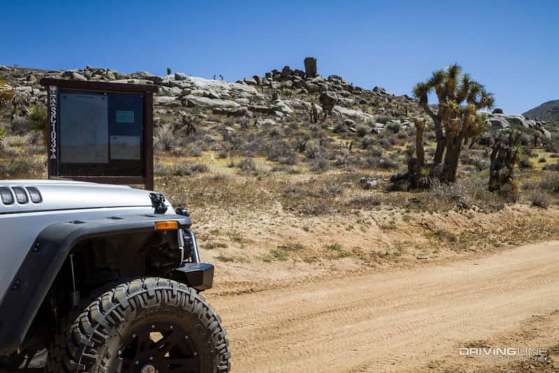
We picked up the trailhead 17 miles south of Weldon, on Kelso Valley Road. It is designated SC103 on the trail and on maps.
The truth is, Dove Springs Canyon is an exceeding well-maintained sandy wash trail that doesn’t require high clearance and as of right now. It could probably be driven in a passenger car if the driver knows how to drive in sand.
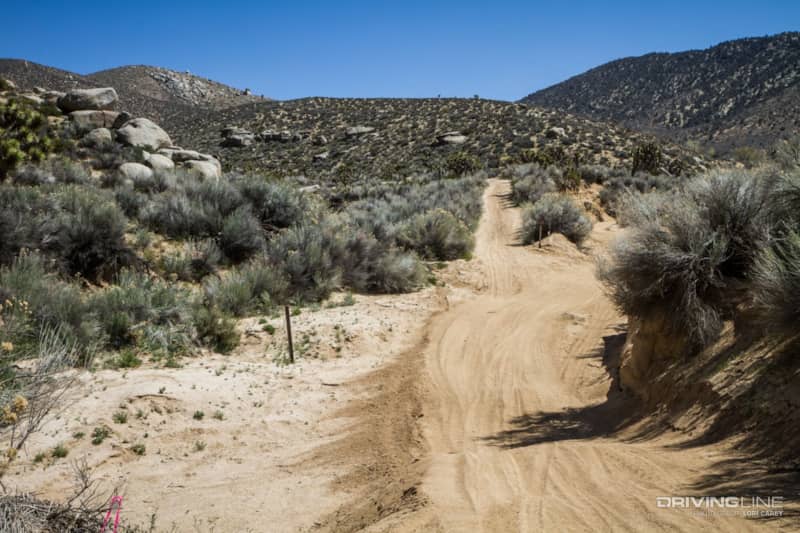
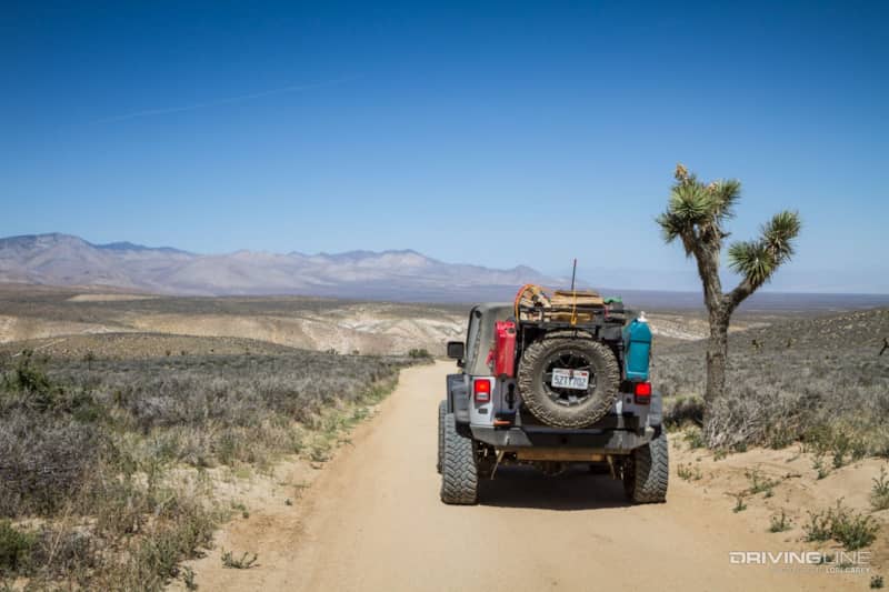
This is as difficult as it got.
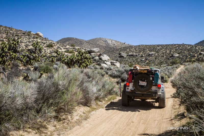
You will definitely need your sand driving skills because the sand is deep and loose in some sections. We spend so much time driving in desert sand that we take it for granted, until we remember that the last time we were out here we had to recover a truck that got stuck in the sand.
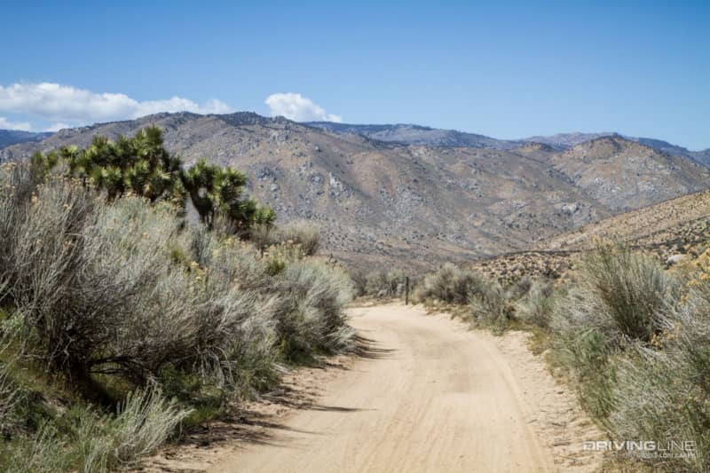
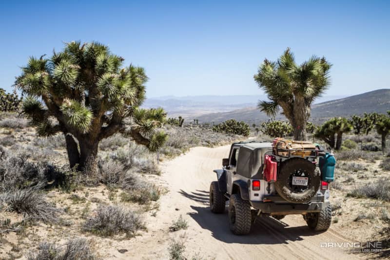
Although the scenery is not unpleasant, there is nothing remarkable about it. It is typical high desert terrain with sand, rocks, desert scrub and some Joshua trees.
The trail reaches an elevation of 5,300 feet at the saddle, but the ascent is so gradual that you don’t notice you are climbing until you catch a glimpse of the valley down below.
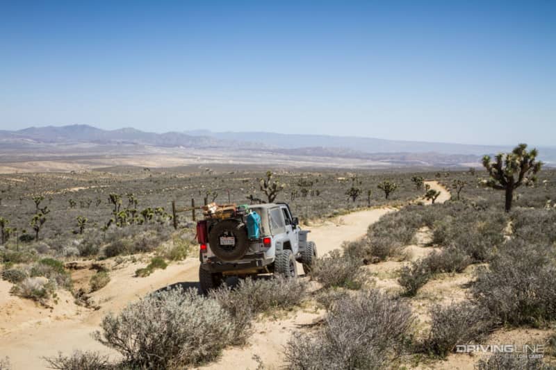
The trail then drops into Dove Spring Canyon, where it passes Dove Spring before it enters the open riding OHV area. After you pass Dove Spring the sand gets firmer.
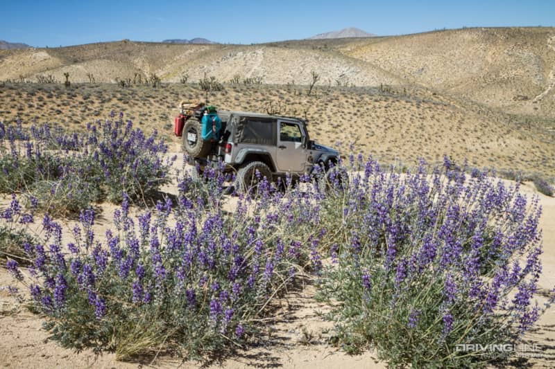
Desert lupine was in full bloom.
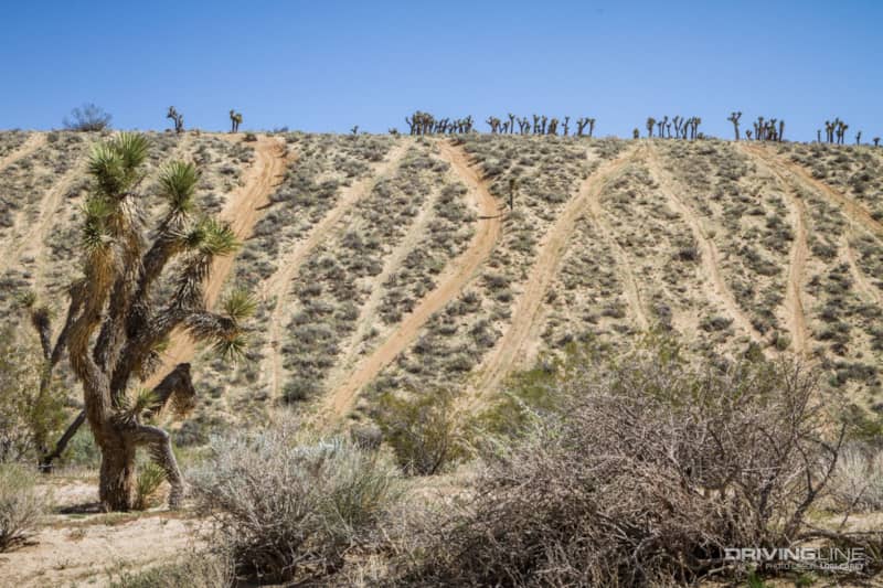
In the open riding area, the hills are scarred with the super-steep ascent trails favored by bikes and UTV riders.
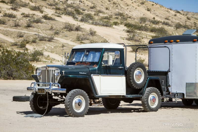
We did spot this super cool Willys truck camped in the OHV area. These trucks were made by Willys-Overland Motors from 1947 to 1965. We were hoping the owner was in camp so we could ask him about it, but we guess he was out playing in whatever toys he hauled in the trailer.
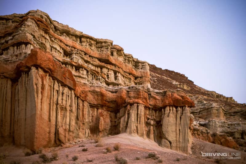
A change to the directions in Massey & Wilson’s Back Country Adventures – SC 103 is now routed directly through the Dove Springs Open OHV area. If you instead turn right on the trail marked SC99 before you reach the open area, and then turn onto SC175, you can follow the route set out in the book that ends at Ricardo Campground in Red Rock Canyon State Park. Red Rock Canyon has dramatic rock formations and cliffs, and the large campground has pit toilets, water, fire rings and picnic tables. It’s a great place to camp if you don’t want to primitive camp in the back country, or if you want to avoid the noisy crowds at the OHV area.
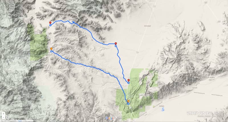
As much as we hate to say it, we recommend to skip this trail and don’t waste your time unless you are a looking for a fast and easy way to get from Point A to Point B. It suited that purpose for us, but it wasn’t worth listening to our co-pilot tell us how boring it was for 18 miles. In case you decide to make a loop as we did with Bird Spring Pass, we’re showing both on the map here so you can see where they are in relation to each other. Bird Spring Pass is to the north and has red markers, Dove Spring Canyon is below it with orange markers.
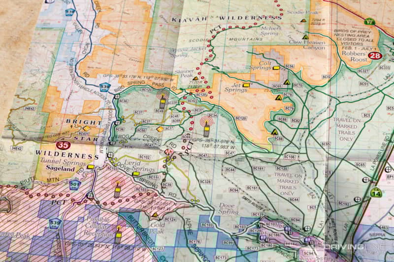
One important piece of advice if you plan to travel off-road in this Jawbone/Dove Springs/Red Rock/El Paso Mountains area – online maps and older trail books don’t cut it here. There is an amazing network of Jeep trails throughout these interconnected areas, but trails/route numbers are often incorrectly labeled on many maps and it is extremely easy to get lost if you try to rely on them. Do yourself a big favor and stop at Jawbone Station to pick up the trail map by Friends of Jawbone Canyon. It is only $3 and is hands down the best off-road trail map we have ever seen. Not only does it make route finding much easier, the map shows where you can get cell phone reception, where the nearest gas stations can be found, has gps coordinates for many points of interest, phone numbers for emergency services, and contains just about any other information you might need.