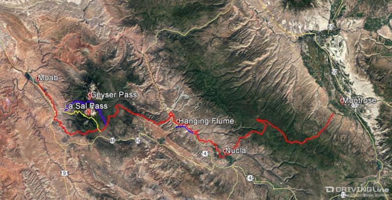
The Rimrocker Trail: 160 Miles of Dirt & Adventure From Montrose to Moab
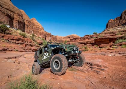
Moab is always a popular destination for adventure and four-wheeling, but with soaring temps in the Moab valley during the middle of summer, we were looking for a cooler adventure and to try something new. During our time at the Easter Jeep Safari this year, we picked up some trail information at the vendor show on a trail called Rimrocker. While the various roads and trails have always been there, the recently developed Rimrocker Trail strings them all together in a 160-mile route from Montrose, Colorado, to Moab, Utah.
We left Highway 550 with a full tank of gas and proceeded west along Main Street in Montrose and then turned on State Road 90 towards the trailhead for Rimrocker. The first part of the trail crosses the Uncompahgre Plateau along a smooth graded dirt road. The plateau itself is 25 miles wide and 100 miles long and is at an elevation of 9,000 feet. Once in the forest, there are many spots for camping and other forest roads to explore. The trail soon drops in elevation as it winds into the small town of Nucla where there is gas and other services.
Leaving Nucla
After leaving Nucla, the trail zig-zags before making a left turn on a lesser road across an area known as Second and Third Park. There is private property in this area, so stick to the designated road. The La Sal Mountains near Moab come into view here as well as views of the plateau we had just crossed. This stretch of the trail offers very little shade and is rough enough that the pace becomes slower.
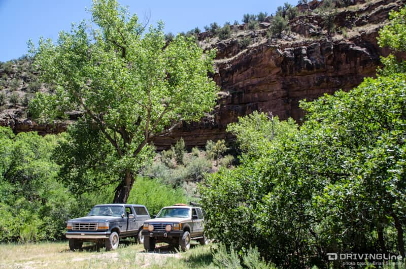
Once the trail dropped down into a canyon, we found a nice shade tree backed up with a cliff wall and flowing stream to stop for a lunch break. There is an option here to continue out to Highway 141 and a developed campsite and picnic area, but we stopped here instead to avoid as much blacktop as possible. At this point we were roughly 70 miles into the route.
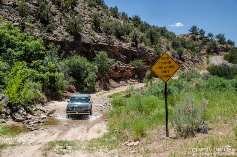
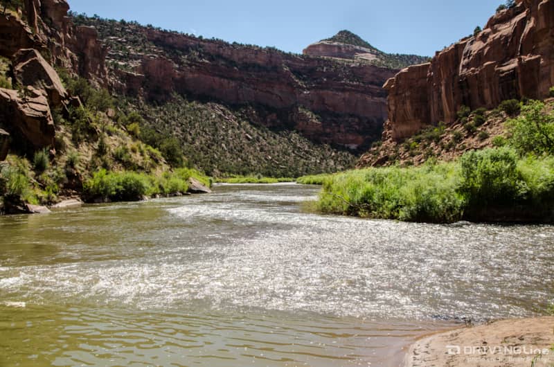
Immediately after our lunch stop, we encountered the first of several water crossings on our adventure. This is the only one along the Rimrocker that is known to get deep during spring runoff. In July it was less than a foot deep at the time of our crossing. When the water is rapidly flowing and deep, heed the warning on the sign and backtrack to 141 until the next access point to return to the trail.
What Is a 'Rimrocker'?
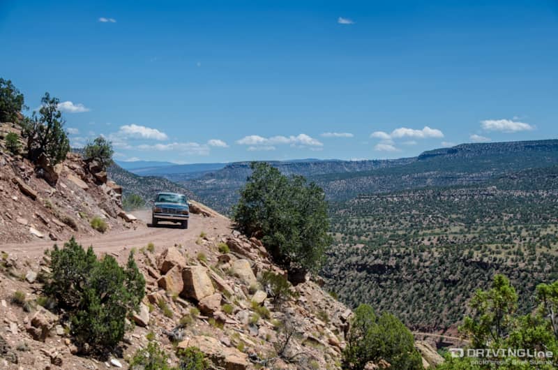
After a gradual climb, we were on top of Spring Creek Mesa and driving along a shelf road with great views along the valley and of the San Miguel River far below. We started to think Rimrocker gets its name from following the edge of so many different mesas and plateaus! We later learned that, according to one account, a Rimrocker was an outlaw who would hide out in the valley after robbing banks in Telluride to the east.
Soon we began to see evidence of mining along the trail from the late 1800s into the 1970s near Uravan. This area is rich in radium, vanadium and uranium. Another source lists a Rimrocker as a person who worked in the many mines scattered around this area.
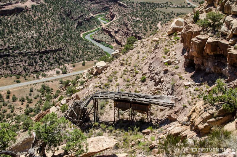
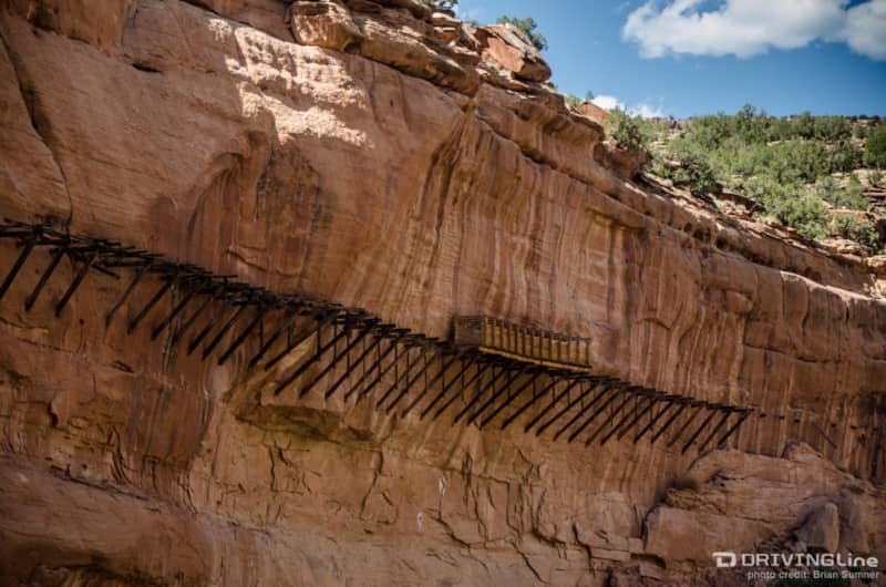
The Hanging Flume
A great detour to take is to see the hanging flumes along the canyon wall high above the San Miguel River. Take an access road to 141, cross over the river and follow the dirt for a few miles. Soon you will see a reconstructed portion of the flume which transported water over 10 miles, seven of which were along canyon walls for use in hydraulic mining. It was quite the engineering feat in the 1890s. The reconstructed flume box was completed in 2004.
Farther down the canyon past the hanging flumes is the confluence of the Dolores and San Miguel rivers. The fast-moving San Miguel empties into the slow-moving Dolores. The road continues down the canyon from here into Paradox Valley, but we returned to the Rimrocker from this point.
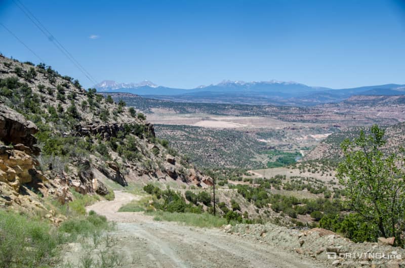
The trail begins a steep descent into southwestern Colorado’s canyon country and the Dolores River running along Highway 141. The switchbacks curved between the canyon walls and large boulders, eventually leading us into a short stretch of pavement and a bridge to cross the river before returning to dirt. This area has a layer of Navajo Sandstone that is the same type of rock found in Utah.
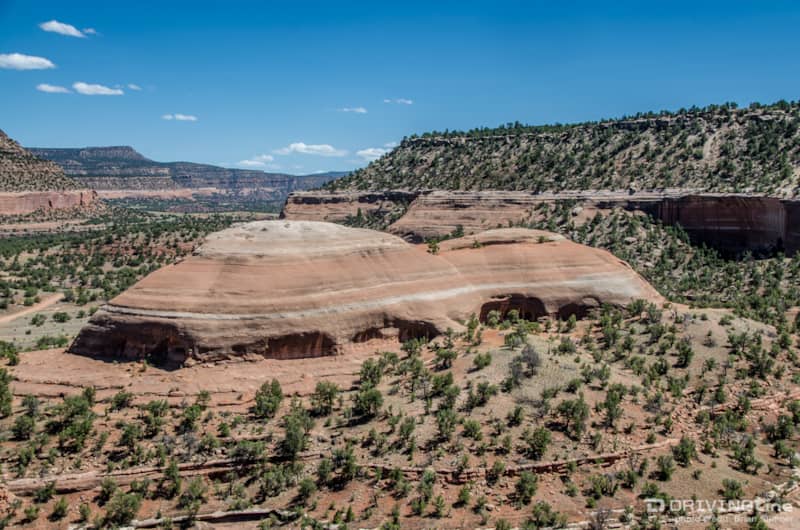
As the trail steeply climbs out of the valley, it becomes rougher with rocks and small sandstone slabs dispersed within the dirt road. A hidden Navajo Sandstone rock formation appears below. The road begins to smooth out again near the Colorado and Utah border.
The La Sal Mountains
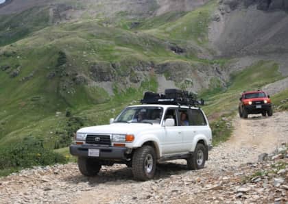
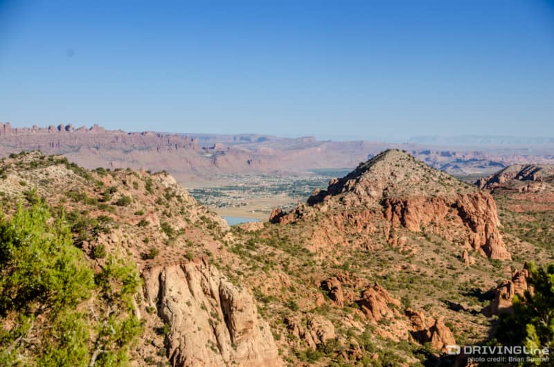
We reached a fork in the Rimrocker Trail late in the day and decided to detour once again and head high into the La Sal Mountains via Geyser Pass. We found a campsite for the night near the Gold Basin fork. The next morning we made our way down the western side of the La Sals and got our first sight of Moab.
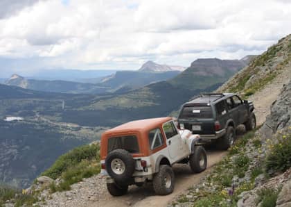
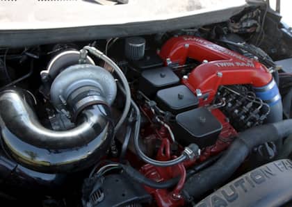
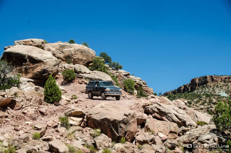
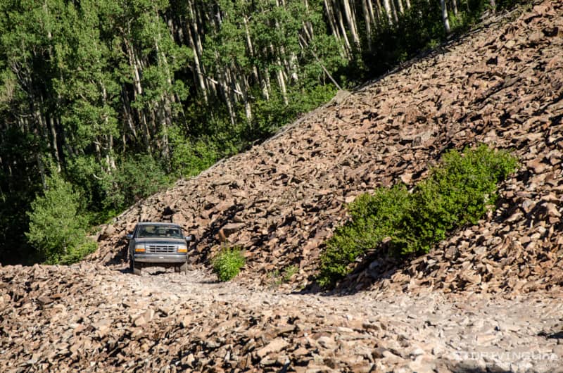
To return to the Rimrocker Trail, we headed up La Sal Pass. From the start, this trail required four low and was the most technical trail we encountered our entire trip. A few miles from the top we crossed a talus shelf road. The loose rocks constantly shifted below our vehicles as we crossed. Having tires with aggressive sidewalls like Nitto Ridge Grapplers is beneficial here to defend against the sharp edges of the rocks.
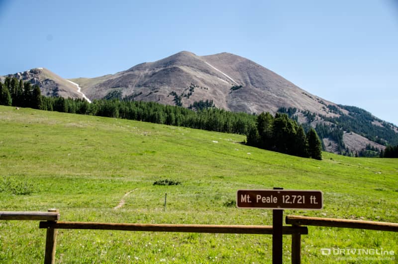
At the top of La Sal Pass the road becomes a graded dirt road down the other side. Mount Peale rises from a large meadow at the pass and offers a few hiking trails to explore. We continued on, working our way back to the Rimrocker Trail.
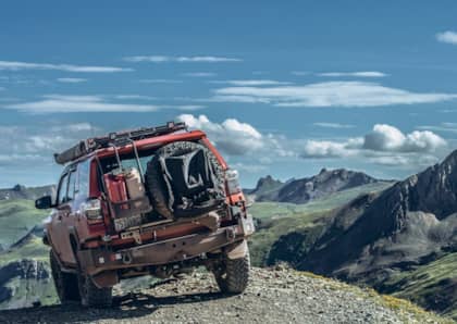
The Final Push Into Moab
We rejoined the Rimrocker at the bottom of La Sal Pass and continued west. The trail once again became very rocky with ruts and tight brush lining both sides. The navigation became tricky with several hidden turns. Eventually we came out to Highway 191 passing by Area BFE and into Moab to finish up our trip. We would recommend bypassing the final section and either taking La Sal Pass into Moab or out Two Mile Road to Highway 46. Our route as described with the side trips was approximately 215 miles.
Travel Tips
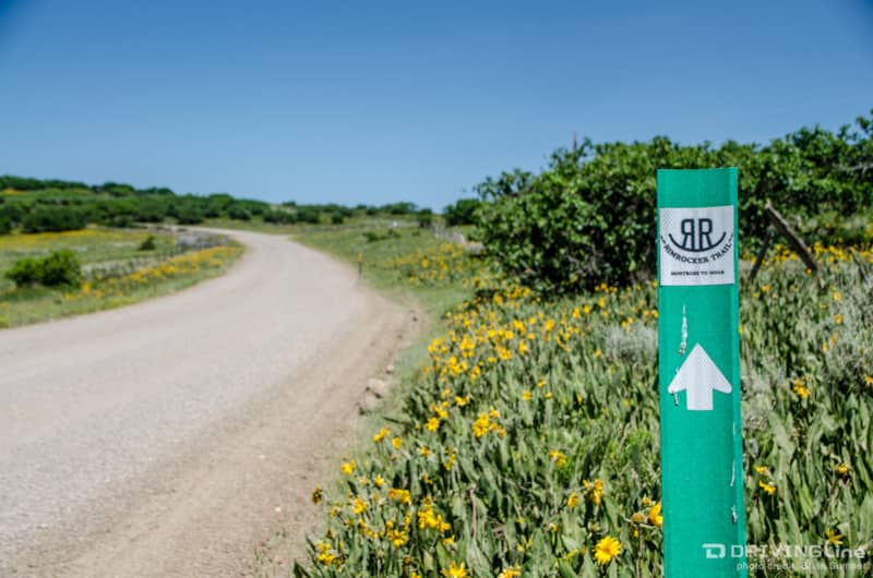
- The trail is well marked with sign posts. A GPS came in handy a few times.
- Maps and an informational brochure can be picked up at the visitors center in Montrose or Naturita.
- The entire trail usually opens by June depending on snowpack.
- Best time to travel would be early summer for wildflower viewing or during the fall colors.
- The trail is suitable for stock high-clearance 4x4 vehicles with good tires.